History of the study of Siberia and the Far East. Khabarov, Poyarkov. The beginning of the study of Siberia by scientific expeditions The study of Siberia and the Far East
It was in the 17th century that it became widespread. Enterprising merchants, travelers, adventurers and Cossacks were heading east. At this time, the oldest Russians were founded, some of them are now megacities.
Trade in Siberian furs
The first detachment of Cossacks appeared in Siberia during the reign of Ivan the Terrible. The army of the famous ataman Yermak fought with the Tatar Khanate in the Ob basin. It was then that Tobolsk was founded. At the turn of the XVI and XVII centuries. started in Russia Time of Troubles. Due to the economic crisis, famine and Polish military intervention, as well as peasant uprisings the economic development of distant Siberia was suspended.
Only when the Romanov dynasty came to power, and order was restored in the country, did the active population again direct their gaze to the east, where vast spaces were empty. In the 17th century, the development of Siberia was carried out for the sake of furs. Fur was valued in European markets worth its weight in gold. Those wishing to cash in on trade organized hunting expeditions.
At the beginning of the 17th century, Russian colonization mainly affected the taiga and tundra regions. Firstly, it was there that valuable furs were located. Secondly, the steppes and forest-steppes were too dangerous for the settlers because of the threat of invasions by local nomads. Fragments of the Mongol Empire and Kazakh khanates continued to exist in this region, the inhabitants of which considered the Russians to be their natural enemies.
Yenisei expeditions
On the northern route, the settlement of Siberia was more intense. At the end of the 16th century, the first expeditions reached the Yenisei. In 1607, the city of Turukhansk was built on its shore. For a long time it was the main transit point and springboard for the further advancement of Russian colonists to the east.
Industrialists were looking for sable fur here. Over time, the number of wild animals has decreased significantly. It became an incentive to move on. The Yenisei tributaries Nizhnyaya Tunguska and Podkamennaya Tunguska were guiding arteries deep into Siberia. At that time, cities were just winter quarters, where industrialists stopped to sell their goods or wait out severe frosts. In spring and summer, they left the parking lot and almost all year round mined fur.
Pyanda's journey
In 1623, the legendary traveler Pyanda reached the banks of the Lena. Almost nothing is known about the identity of this man. A few information about his expedition was passed by industrialists by word of mouth. Their stories were recorded by the historian Gerard Miller already in the Petrine era. The exotic name of the traveler can be explained by the fact that he belonged to the Pomors by nationality.
In 1632, on the site of one of his winter quarters, the Cossacks founded a prison, which was soon renamed Yakutsk. The city became the center of the newly created voivodeship. The first Cossack garrisons faced the hostile attitude of the Yakuts, who even tried to besiege the settlement. In the 17th century, the development of Siberia and its most distant frontiers was controlled from this city, which became the northeastern border of the country.

Character of colonization
It is important to note that colonization at that time was of a spontaneous and popular nature. At first, the state practically did not interfere in this process in any way. People went east on their own initiative, taking all the risks on themselves. As a rule, they were driven by the desire to make money on trading. Also, peasants who fled from their native places, fleeing from serfdom, rushed to the east. The desire to gain freedom pushed thousands of people into unexplored spaces, which made a huge contribution to the development of Siberia and the Far East. The 17th century made it possible for peasants to start new life on the new earth.
The villagers had to go to a real labor feat in order to start a farm in Siberia. The steppe was occupied by nomads, and the tundra turned out to be unsuitable for cultivating the land. Therefore, the peasants had to arrange arable land in dense forests with their own hands, winning plot after plot from nature. Only purposeful and energetic people could cope with such work. The authorities sent detachments of service people after the colonists. They did not so much discover lands as they were engaged in the development of those already open, and were also responsible for security and tax collection. That is how a prison was built in the southern direction, on the banks of the Yenisei, to protect civilians, which later became the rich city of Krasnoyarsk. This happened in 1628.

Dezhnev's activities
The history of the development of Siberia imprinted on its pages the names of many brave travelers who spent years of their lives on risky ventures. One of these pioneers was Semyon Dezhnev. This Cossack ataman was from Veliky Ustyug, and went east to engage in fur hunting and trade. He was a skilled navigator and spent most of his active life in the northeast of Siberia.
In 1638 Dezhnev moved to Yakutsk. His closest associate was Pyotr Beketov, who founded such cities as Chita and Nerchinsk. Semyon Dezhnev was engaged in collecting yasak from the indigenous peoples of Yakutia. It was a special type of tax imposed by the state for the natives. Payments were often violated, as local princes periodically rebelled, not wanting to recognize Russian power. It was for such a case that detachments of Cossacks were needed.

Ships in the Arctic seas
Dezhnev was one of the first travelers who visited the banks of rivers flowing into the Arctic seas. We are talking about such arteries as Yana, Indigirka, Alazeya, Anadyr, etc.
Russian colonists penetrated into the basins of these rivers in the following way. First, the ships descended along the Lena. Having reached the sea, the ships went east along the continental coasts. So they fell into the mouths of other rivers, rising along which, the Cossacks found themselves in the most uninhabited and outlandish places in Siberia.
Opening of Chukotka
Dezhnev's main achievements were his expeditions to Kolyma and Chukotka. In 1648 he went to the North to find places where he could get a valuable walrus bone. His expedition was the first to reach here Eurasia ended and America began. The strait separating Alaska from Chukotka was not known to the colonialists. Already 80 years after Dezhnev, Bering's scientific expedition, organized by Peter I, visited here.
The journey of desperate Cossacks lasted 16 years. It took another 4 years to return to Moscow. There, Semyon Dezhnev received all the money due to him from the tsar himself. But the importance of his geographical discovery became clear after the death of the brave traveler.

Khabarov on the banks of the Amur
If Dezhnev conquered new frontiers in the northeast direction, then in the south there was a hero. They became Erofey Khabarov. This discoverer became famous after he discovered salt mines on the banks of the Kuta River in 1639. was not only an outstanding traveler, but also a good organizer. The former peasant founded the salt production in the modern Irkutsk region.
In 1649, the Yakut governor made Khabarov the commander of a Cossack detachment sent to Dauria. It was a remote and poorly studied region on the borders with Chinese empire. Natives lived in Dauria, who could not offer serious resistance to Russian expansion. Local princelings voluntarily passed into the citizenship of the king, after a detachment of Erofei Khabarov turned out to be on their lands.
However, the Cossacks had to turn back when the Manchus came into conflict with them. They lived on the banks of the Amur. Khabarov made several attempts to gain a foothold in this region by building fortified fortresses. Due to the confusion in the documents of that era, it is still not clear when and where the famous pioneer died. But, despite this, the memory of him was alive among the people, and much later, in the 19th century, one of the Russian cities based on the Amur was named Khabarovsk.

Disputes with China
The South Siberian tribes, passing into the citizenship of Russia, did this in order to escape the expansion of the wild Mongol hordes, who lived only by war and the ruin of their neighbors. Duchers and Daurs suffered especially. In the second half of the 17th century foreign policy situation in the region became even more complicated after the restless Manchus took over China.
The emperors of the new Qing Dynasty began aggressive campaigns against the peoples living nearby. Russian government tried to avoid conflicts with China, because of which the development of Siberia could suffer. In short, diplomatic uncertainty in the Far East persisted throughout the 17th century. It wasn't until the next century that states entered into a treaty that formally defined the borders of countries.

Vladimir Atlasov
In the middle of the 17th century, Russian colonists learned about the existence of Kamchatka. This territory of Siberia was shrouded in secrets and rumors, which only multiplied over time due to the fact that this region remained inaccessible even to the most daring and enterprising Cossack detachments.
"Kamchatsky Ermak" (in the words of Pushkin) was the explorer Vladimir Atlasov. In his youth, he was a yasak collector. public service was given to him easily, and in 1695 the Yakut Cossack became a clerk in the distant Anadyr prison.

His dream was Kamchatka... Having found out about it, Atlasov began to prepare an expedition to a distant peninsula. Without this enterprise, the development of Siberia would be incomplete. The year of preparation and collection of the necessary things was not in vain, and in 1697 the trained detachment of Atlasov set off.
Exploration of Kamchatka
The Cossacks crossed the Koryak Mountains and, having reached Kamchatka, were divided into two parts. One squad went along West Bank, the other studied the east coast. Having reached the southern tip of the peninsula, Atlasov saw from afar the islands, previously unknown to Russian explorers. It was the Kuril archipelago. In the same place, among the Kamchadals in captivity, a Japanese named Denbey was discovered. was shipwrecked and fell into the hands of the natives. The liberated Denbey went to Moscow and even met with Peter I. He became the first Japanese that the Russians had ever met. His stories about his native country were popular objects of conversation and gossip in the capital.
Atlasov, having returned to Yakutsk, prepared the first written description of Kamchatka in Russian. These materials were called "fairy tales". They were accompanied by maps compiled during the expedition. For a successful campaign in Moscow, he was awarded a reward of one hundred rubles. Atlasov also became a Cossack head. A few years later he returned to Kamchatka once again. The famous pioneer died in 1711 during a Cossack riot.

Thanks to such people, in the 17th century, the development of Siberia became a profitable and useful enterprise for the whole country. It was in this century that the distant land was finally annexed to Russia.
Biography Dezhnev S.I. Semyon Ivanovich Dezhnev (from 1605, Veliky Ustyug, early 1673, Moscow) Russian traveler, explorer, navigator, explorer of Northern and Eastern Siberia, Cossack ataman, fur trader. The first known navigator who passed through the Bering Strait, which connects the Arctic Ocean with the Pacific and separates Asia and North America, Chukotka and Alaska, and did this 80 years before Vitus Bering, in 1648.

During the 40 years of his stay in Siberia, Dezhnev participated in numerous battles and strikes, received at least 13 wounds. In 1646, S. Dezhnev once again had to face in battle with an enemy who was superior in strength. However, from the Siberian tribes, the Yukaghirs, decided to attack the prison, guarded by a garrison of only a dozen and a half people. But the brave Cossack managed to defend Nizhnekolymsk from five hundred attackers.

CHUKOTA EXPEDITION - in 1648 Dezhnev joined the fishing expedition of Fedot Popov. In the summer they went to the Arctic Ocean. The expedition was difficult, only three ships managed to get to the eastern end of the coast and go around the BIG STONE NOSE.

In 1662, Dezhnev returned to Yakutsk, and then left for Moscow with the tribute collected in Siberia. Here he received the rank Cossack ataman. In 1665, Semyon Ivanovich Dezhnev went back to Yakutsk, and in 1670 he again brought tribute to Moscow. At the beginning of 1672, he arrived in the capital, where, apparently, he fell ill, and a year later, at the beginning of 1673. , died.

Special scientific expeditions began to be sent to Siberia only from the 18th century. But even before that, inquisitive Russian explorers collected in Siberia a lot of different information that had great importance for science.
Thanks to the early Russians northern campaigns“for a stone” (Ural) already in the 16th century. in Western Europe the first geographic maps based on Russian sources appeared with the image of the lower Ob. Despite the fact that Russian explorers, especially Novgorodians, began to visit these areas as early as the 11th century, nevertheless, for a long period, mainly semi-fantastic information about Siberia was disseminated in Russia itself. Yes, in the story early XVI in. "About the unknown people on eastern country and the tongue of roses" it was claimed that extraordinary people live beyond the Urals: some - "without heads", and "they have their mouths between their shoulders", others ("linna samoyed") - "spends all summer in the water", still others - "walk on dungeon" 1, etc. Only thanks to the subtle analysis of D. N. Anuchin, it was possible to more or less correctly determine what kind of real data underlay this semi-fantastic "Tale". 2
The rapid accumulation of quite reliable information about Siberia began from the time of the historical campaign of Yermak, and especially after the appointment of the first Siberian governors. The government obliged the "initial people" of Siberia to carefully collect information about the routes of communication, fur wealth, mineral deposits, the possibility of organizing arable farming, the number and occupations of the local population, and its relationship with neighboring peoples. The leaders of the detachments building fortified points on the newly occupied terrain were also required to draw up drawings of the area and the built prisons.
The collection of information about new lands usually began with a survey of local residents. Therefore, the campaigns, as a rule, were attended by "interpreters" - experts in local languages. Participants of the campaigns in their "arrivals", replies and petitions supplemented and clarified this information with personal observations. The governors and other local "primary people" often questioned the participants in the campaigns and wrote down their answers. This is how the “speech speeches” and “tales” of the explorers arose. The governors sent the most important documents to Moscow with their replies, in which they concisely summarized the information collected. Thus, geographical, ethnographic, economic, historical and other material was accumulated.
Rapidly advancing into the depths of Siberia, explorers were primarily interested in river routes and convenient portages between rivers. So, for example, the Cossacks who built the Yenisei prison in 1619, in the same year reported to Moscow about the unnamed “great river” (Lena), to which from Yeniseisk “it takes 2 weeks to go to the portage, and then go 2 days by portage” . 3 By the middle of the XVII century. the explorers knew literally all the major rivers of Siberia and their main tributaries, had a general idea of their water regime, were well acquainted with difficult sections of the path, especially with the rapids.
Off the coast of Siberia, the Russians began to explore the sea routes early. At the end of the XVI century. they went on ships along the dangerous Gulf of Ob to the mouth of the river. Taz, and in the 30s of the XVII century. began to sail for the first time in the easternmost part of the Arctic Ocean - from the mouth of the Lena. In 1648, Semyon Ivanovich Dezhnev and his companions, rounding Chukotka, were the first Europeans to cross the strait separating Asia from America.
Quite quickly, Russian explorers got an idea about the seas of the Far East. October 1 (NS - 11), 1639 I. Yu. Moskvitin and his comrades on a short voyage from the mouth of the river. Hives to the river. Hunting laid the foundation for Russian Pacific navigation, and in the navigation of 1640, having built two eight-yard kochs, the Muscovites sailed to the area of the mouth of the Amur and the "Islands of the Gilyatskaya Horde" - the islands of the Sakhalin Bay, inhabited by settled Nivkhs. 4 One of the discoverers of the Kolyma, M. V. Stadukhin, significantly expanded the understanding of the Russians about the Pacific Ocean. In 1651, having passed overland from Anadyr to Penzhina, he sailed for two navigations along the northern part of the Sea of Okhotsk to the Tauyskaya Bay, and then in 1657 to the river. Hunting. He was one of the first to learn from local residents about the existence of a "nose" between Anadyr and Penzhina, that is, the Kamchatka Peninsula, 5 however, the true size of this peninsula did not become known immediately. However, already in the middle of the XVII century. in Moscow they knew that from the east the “new Siberian land” was also washed everywhere by the “Akian sea”.
During voyages in the Arctic and Pacific oceans, sailors conducted various observations. According to the outlines of the shores, they remembered the passed sea routes, followed the direction of the winds, the drift of ice, and sea currents. Even then they knew how to use a compass (“womb”) and determine the general contours of not only small, but also large peninsulas. In S. I. Dezhnev’s reply in 1655, a rather accurate description of the location of the “Big Stone Nose” (Chukotka Peninsula) from Anadyr turned out to be quite accurate: “and that Nose lies between the siver on a midnight”, 6 i.e. in the sector between two directions - on north and northeast. "The nose will turn sharply towards the Onandyra river towards summer." 7 This phrase means that Dezhnev attributed the beginning of the Chukotka Peninsula from the south side to the Gulf of the Cross (the region of Mount Matachingai), which corresponds to the ideas
1 A. Titov. Siberia in the 17th century. Collection of old Russian articles about Siberia and adjacent lands. M., 1890, pp. 3-6.
2 D. N. Anuchin. On the history of acquaintance with Siberia before Yermak. Antiquities, vol. XIV, M., 1890, p. 229.
3 RIB, vol. II, St. Petersburg, 1875, doc. No. 121, p. 374.
4 Materials of the Department of Historical and Geographical Knowledge of the Geographical Society of the USSR, no. 1, L., 1962, pp. 64-67.
5 Russian sailors in the Arctic and Pacific Oceans. Collection of documents about the great Russian geographical discoveries in the northeast of Asia in the 17th century. Comp. M. I. Belov. L.-M., 1952, p. 263.
6 DAI, vol. IV, St. Petersburg, 1851, No. 7? page 26.
7 See photocopy of document: Vestn. ASU, 1962, No. 6, ser. geologist, and geogr., vol. 1, p.
modern geographers. 8 Thus, for the first time, reliable information was obtained about the extreme northeastern part of Asia, which is closest to North America.
In the 17th century Anadyr Cossacks were the first to find out about the existence of Alaska. For them, it was the "Island of the Toothed" (Eskimos), or the "Great Land", then they did not yet know that Alaska was part of America.
Valuable information was collected in the 17th century. about the countries located south of Siberia. The earliest reports about routes from Siberia to Central and Central Asia were received from Central Asian intermediary merchants, the so-called "Bukharians", some of whom settled in Western Siberia. They also helped the Russians find their way to China, get early information about the Tibetans and even about distant India.
In expanding our understanding of southern countries rather frequent Russian embassies, in which the Siberian service people took an active part, played an important role. So, the Tomsk Cossack Ivan Petlin, who was the first to travel to China in 1618, presented to Moscow an article list in which he described in detail the route of his journey, as well as "a drawing and painting about the Chinese region." 9
A lot of information about the peoples living south of Siberia, the Russians received from local residents. Important news about Mongolia and about new routes to China was received from the Selenga Tungus and Buryats. Russians learned from the natives of the Amur in 1643-1644. about the Manchus, and in 1652-1653. - about the Japanese (“chizhems”), whose nearest settlements at that time were in the southern part of the island of Hokkaido (“Iesso”). 10 The Cossack campaigns of 1654-1656 were of great importance for expanding the understanding of Russians about the southern peoples. on the right tributaries of the Amur - Argun, Komaru, Sungari ("Shingal") and Ussuri ("Ushur"). Through the Argun, a new shorter route to China was opened, along which the embassies of Ignatius Milovanov (1672) and Nikolai Spafariy (1675-1677) later went to Beijing.
The most detailed and rich material was accumulated in the 17th century. about the interior regions of Siberia - about the local population, fauna, flora, minerals.
When collecting yasak, servicemen were interested in the number, ethnic and tribal composition of the local population, and the location of the settlements. In addition, their messages contain rich information about social relations among local peoples, the way of life - about taiga and river crafts, about hunting tools and means of transportation, about domestic animals, about the arrangement of dwellings. All these data are still of great value to researchers, especially ethnographers.
Of the natural resources that attracted in the XVI-XVII centuries. to Siberia of Russian people, in the first place was furs (“soft junk”). In the Russian and world markets in the XVI-XVII centuries. the furs of sables, beavers, silver foxes were especially valued. Among the Russian people in Siberia there were many experienced animal experts. They knew the areas of fur-trading lands well, studied the habits of sable and other animals, mastered various methods of hunting them, knew how to process furs and were considered knowledgeable connoisseurs of its various varieties.
They also successfully hunted the sea animal - seals, seals, and later whales. But the Russians were especially interested in the walrus tusk (“fish
8 B. P. Polevoy. On the exact text of two replies by Semyon Dezhnev in 1655. Izv. USSR Academy of Sciences, ser. Geogr., 1965, No. 2, pp. 102-110.
9 N. F. Demidova, V. S. Myasnikov. The first Russian diplomats in China. M., 1966, p. 41.
10 B. P. Polevoy. Sakhalin pioneers. Yuzhno-Sakhalinsk, 1959, p.31.
tooth"), which was valued in the XVII century. very high and was sold to some countries of the East. Therefore, when in the middle of the XVII century. rich walrus rookeries were discovered in the north-east of Siberia, Moscow immediately became interested in them.
The explorers were also connoisseurs of the Siberian fish wealth. In their messages they list a wide variety of fish. So, in November 1645, V. D. Poyarkov’s companions told in Yakutsk that in the mouth of the Amur there is not only red fish, but “both sturgeon and a big and small stick, and carp and sterlet, and catfish and stellate sturgeon.” 11 The fish riches of the rivers of the Okhotsk coast made a great impression on the Russians. “In the “tale” of the Cossack N.I. Kolobov, a participant in the campaign of I.Yu. Moskvitin, it was said: “... just start the net and do not drag it out with the fish. And the river is fast, and that fish in that river quickly kills and sweeps ashore, and along its bank there is a lot that firewood, and that lying fish is eaten by a beast. 12
Among the explorers were the so-called "herbalists", who were engaged in the search and collection of plants "for medicinal compounds and vodkas." St. John's wort, "wolf root", rhubarb were in special demand.
Wherever the Siberian explorers penetrated, everywhere they were interested in minerals. 13 First of all, they began to collect information about salt springs. Detailed descriptions (XVII century) of the state-owned salt industry on the lake have come down to us. Yamysh (20s) and salt pans of E.P. Khabarov on the river. Kuta (30s). In the late 30s, salt springs were found in the Yenisei district on the tributaries of the river. Angara, Taseev and Manze. In the late 60s, salt was found near Irkutsk (Usolye). fourteen
Already from the beginning of the XVII century. ores were searched in Siberia, especially iron, copper and silver. From the 1920s, a successful search for iron ore was carried out by the Tomsk ore explorer blacksmith Fedor Yeremeev. As the Tomsk governor reported to Moscow, from the ore found by Eremeev, “was born. . . iron is good. 15 In the middle of the XVII century. "the kindest and softest" iron was smelted from ore found near Krasnoyarsk, as well as in the Yeniseisk region. The Russians found copper ore on the Yenisei and in Western Siberia.
Silver ore was most persistently searched for. The first searches were unsuccessful, but in the second half of the XVII century. rather rich deposits were found in Transbaikalia. The famous Nerchinsk factories were built here. Even then, the Russians knew that lead, and sometimes tin, was often found in the areas of silver ore deposits. The replies of the explorers also report on the search for "combustible" sulfur, saltpeter
11 TsGADA, f. Yakut order hut, op. 1, column. 43, l. 362.
12 Ibid., op. 2, column. 66, l. one. Full text of this "sketch" see: N. N. Stepanov. The first Russian expedition on the coast of Okhotsk in the 17th century. Izv. VGO. v. 90, 1958, No. 5, pp. 446-448.
13 Review of published messages of the 17th century. about the minerals of Siberia is given in the book by A. V. Khabakov “Essays on the history of geological exploration knowledge in Russia” (part 1, M., 1950), and archival documents of the Siberian order - in the article by N. Ya. Novombergsky, L. A. Goldenberg and V.V. Tikhomirov "Materials on the history of exploration and prospecting for minerals in the Russian state of the 17th century." (in the book: Essays on the history of geological knowledge, issue 8, M., 1959. pp. 3-63).
14 F. G. S afronov. Erofei Pavlovich Khabarov. Khabarovsk, 1956, p. 13; A. N. Kopylov. Russians on the Yenisei in the 17th century. Agriculture, industry and trade relations of the Yenisei district. Novosibirsk, 1965, pp. 186-189; V. A. Alexandrov. Russian population of Siberia in the 17th-early 18th centuries. (Yenisei Territory). M., 1964, p. 248; TsGADA, joint venture, st. 113, ll. 210, 211; stlb. 344, ll. 333-336: stlb. 908, ll 117-136,371-376.
15 For more details on the activities of F. Eremeev, see: A. R. Pugachev. 1) Fedor Eremeev - the discoverer of the iron ores of Siberia. Questions of the geography of Siberia, Sat. 1, Tomsk, 1949, pp. 105-121; 2) Blacksmith Fedor Yeremeev. Tomsk, 1961.
and even oil. 16 Significant progress was made in the search for window mica. In the middle of the XVII century. mica was mined in the lower Angara region (in the upper reaches of the Taseeva and Kiyanka rivers). In the 1980s, the richest deposits of mica were discovered on the shores of Lake Baikal. At the same time, rock crystal was mined in different parts of Eastern Siberia and various “patterned stones” were collected.
Russian explorers sought to reflect their discoveries on geographical drawings. Throughout the 17th century hundreds of such drawings were created. Unfortunately, almost all of them died. But according to the few accidentally preserved drawings and especially the “paintings” for them, it can be seen that they sometimes had a rather significant load: in addition to rivers, mountains and settlements, they often depicted "argish places", "fish grounds", "black forests", drags and even "argishnitsa" - the paths along which "deer people" crossed with argish.
Some of the local drawings of the XVII century. were of particular value. So, in 1655, at the direction of Dezhnev, the first “Anandyr drawing” was drawn up: from the Anyui river and beyond the Kamen to the top of Anandyr, and which rivers flowed large and small, and to the sea and to the corgi where the beast crawls. 17 In 1657, Stadukhin's companions made the first drawing of the northern part of the Sea of Okhotsk. eighteen
Among the drafters of the drawings of the XVII century. were masters of their craft. Such, for example, was Kurbat Ivanov, the discoverer of Lake Baikal and Dezhnev's successor in the Anadyr prison, who compiled the first drawings of the upper Lena, Lake Baikal, the coast of Okhotsk and some other regions of Eastern Siberia. 19 Unfortunately, many exceptionally rich information about Siberia and neighboring peoples, collected in the 17th century, turned out to be buried in the archives and were not used by contemporaries when working on the creation of summary drawings and descriptions of Siberia. Drawing up generalizing Siberian drawings in Russia began to be engaged quite early. It is known that at the end of the XVI century. some kind of "drawing of the Siberian from Cherdyn" was created. 20 In 1598-1599 in Siberia, drawings were made that formed the basis of the Siberian part of the famous "old" drawing of the Muscovite state.
In 1626, a letter was sent from Moscow to Siberia: “Draw a drawing for the city of Tobolsk and all Siberian cities and prisons in Tobolsk.” Having received this order, the Tobolsk governor A. Khovansky immediately sent appropriate orders to all Siberian cities and prisons to the governors: “. . . ordered them to draw drawings and write on the paintings near those cities and forts, rivers and tracts. 21 How this work was carried out is not yet known. Some researchers believe that the “Painting of Siberian Cities and Ostrog”, compiled in 1633, may have been an appendix to such a general drawing of the entire then known part of Siberia. 22
Siberia to the shores of the Pacific Ocean was first depicted in a drawing of 1667. In the absence of local drawings of many regions of Siberia, the Tobolsk governor P. I. Godunov organized a survey of “all kinds of ranks” of experienced people. After summarizing this information, a “drawing of all Siberia” was created and a drawing list was drawn up for it. An analysis of the painting suggests that the "drawing of all Siberia" was made in the form of a kind of atlas, in which all the details were already reflected in the special route drawings of rivers and routes. On 23 November 26, 1667, the "drawing of all Siberia" was sent to Moscow. 24 And in February 1668, based on this drawing, the painter Stanislav Loputsky made another drawing of Siberia in Moscow. 25 In the summer of 1673, under the governor I. B. Repnin, new cartographic work was carried out in Tobolsk: a new drawing of Siberia and a Tobolsk version of the drawing of the entire Muscovite state were drawn up. 26
In the further refinement of the general drawings of Siberia, an important role was played by the head of the Russian embassy in China, N. G. Spafariy, who was instructed by the government "from Tobolsk on the road to the frontier Chinese city to depict all the lands, cities and the path in the drawing" and draw up a detailed description of Siberia. 27 In 1677, Spafarius in Ambassadorial Order"The book was handed over, and in it is written the journey of the kingdom of Siberia from the city of Tobolsk and to the very border of China." 28 In this detailed work, the main rivers of Siberia - the Irtysh and the Ob, the Yenisei and the Lena - are described in particular detail. In addition, a separate description of the Amur was added to the description of China compiled by Spafarius (one of its variants is widely known as the “Legend of the great Amur River”). 29 At the same time, a new drawing of Siberia was submitted to the Posolsky Prikaz.,
Censuses of the population and lands, the so-called "watches", played an important role in the development of Siberian cartography. During the widest "watch" of the early 80s of the XVII century. many local drawings were created, on the basis of which, after 3-4 years, new revised drawings of the whole of Siberia were compiled.
By the mid-80s of the XVII century. also applies to the appearance of a new detailed geographical work about Siberia - “Descriptions of the new land of the Siberian state, at which time and in what case it fell for Moscow State and what is the position of that land. 30 In Stockholm, in the papers of I. Sparvenfeld, the Swedish ambassador to Russia in 1684-1687, a copy of this "Description" and an unfinished copy of the Great Drawing of Asia, which clearly reflected the content of the "Description", were recently found. 31 Therefore, there is reason to believe that the noted "Description" was created in the form of a literary supplement to some new drawing of Siberia instead of the traditional "painting".
16 See: DAI, vol. 10, p. 327.
17 Russian Arctic expeditions of the 17th-20th centuries. Questions of the history of the study and development of the Arctic, L., 1964, p. 139X
18 DAI, vol. 4, 1851, doc. No. 47, p. 120, 121.
19 B P Field. Kurbat Ivanov - the first cartographer of Lena, Baikal and the Okhotsk coast (1640-1645). Izv. VGO, vol. 92. 1960, No. 1, pp. 46-52.
20 CHOIDR, 1894, book. 3, mixture, page 16.
21 RIB, vol. VIII, 1884, column. 410-412.
22 Yu A Limonov. "Painting" of the first general drawing Siberia (dating experience). Problems of source study, VIII, M., 1959, pp. 343-360. The text of the "painting" see: A. Titov. Siberia in the 17th century, pp. 9-22.
23 See for more details: B.P. Polevoy. Hypothesis about the "Godunovsky" atlas of Siberia in 1667. Izv. USSR Academy of Sciences, ser. Geogr., 1966, No. 4, pp. 123-132.
24 TsGADA, joint venture, st. 811, l. 97.
25 This was first reported by G. A. Boguslavsky in a report to the Geographical Society of the USSR on December 14, 1959.
26 See: Book of the Big Drawing. Preparation for publication and editing by K. N. Serbina. M.-L., 1950, pp. 184-188.
27 Journey through Siberia from Tobolsk to Nerchinsk and the borders of China by the Russian envoy Nikolai Spafari in 1675. Travel diary of Spafari with an introduction and notes by Yu. V. Arseniev. Zap. Russian Geographical Society on dep. these., 1882, vol. X, no. 1, App., p. 152.
28 Ibid., pp. 1-214. Most detailed analysis geographical works of N. G. Spafaria, see: D. M. Lebedev. Geography in Russia XVII century (pre-Petrine era). Essays on the history of geographical knowledge. M.-L., 1949, pp. 127-164.
29 A. Titov. Siberia in the 17th century, pp. 107-113.
30 Ibid., pp. 55-100. A more accurate text was reproduced in 1907 in the collection Siberian Chronicles.
31 For a description of the Swedish copy, see: S. D a h 1. Codex ad 10 der Västeräser Gymnasial Bibliothek. Uppsala, 1949, pp. 62-69. The unfinished drawing is reproduced in the article: L. S. Bagrow. Sparwenfeltdt "s maps of Siberia-Imago Mundi, vol. IV, Stockholm, 1954.
The discovery abroad of several drawings of Siberia shows what great interest foreigners showed in it. In the 17th century in Western Europe, a number of works with information about Siberia appeared. Their most complete review is given by Academician MP Alekseev. 32 In the reports of foreigners, most often, reliable interspersed with conjectures. The most truthful writings belonged to the pen of those who themselves visited Siberia. The "History of Siberia" by Yuri Krizhanich (1680), 33 who lived for 15 years in exile in Tobolsk, is especially informative. There, Krizhanich met with many Siberian explorers, which allowed him to collect reliable information about Siberia. Krizhanich, in particular, notes, based on data on Russian campaigns in the mid-17th century, that the Arctic and Pacific oceans are “not separated from each other by anything”, but through navigation through them is impossible due to the accumulation of ice. 34
Of all the works on Siberia that appeared abroad in the 17th century, the most valuable was the book “On Northern and Eastern Tataria” by the Dutch geographer N.K. Witsen (1692). 35 In 1665 its author was in Moscow as a member of the Dutch embassy. Since then, Witsen began to collect various news about the eastern outskirts of Russia. He was especially interested in Siberia. Witsen, through his Russian correspondents, managed to collect a rich collection of various writings about Siberia. Among the materials he used were a drawing of Siberia in 1667 and its painting, a painting of a drawing of Siberia in 1673, an essay on Siberia by Krizhanich, “Description of the new land of the Siberian state”, “The Legend of the Amur River”, etc. In addition, Witsen had such Russian sources, the originals of which are not yet known.
Witsen was also the compiler of several drawings of "Tataria" (Siberia with neighboring countries). Of these, his large map "1687" is the most famous. (actually it was published in 1689-1691). 36 Witsen's map contains many blunders, but nevertheless, for its time, its publication was a great event. In essence, this was the first map in Western Europe that reflected reliable Russian news about all of Siberia.
In 1692, a new Russian ambassador traveled through Siberia to China, the Dane Izbrand Idee. He carried Witsen's map with him. Along the way, Idee made the necessary corrections and later made his own drawing of Siberia, which, however, also turned out to be very inaccurate. 37 It became obvious that the very system of compiling geographical drawings of Siberia should be changed.
Since the most detailed drawings of the voivodships could only be drawn up on the ground, on January 10, 1696, in the Siberian order, it was decided “to send letters from the great sovereigns to all Siberian cities, to order Siberian cities and counties. . . write drawings on canvas. . . And in Tobolsk, order the good and skillful master to make drawings
32 M. P. Alekseev. Siberia in the news of Western European travelers and writers, vols. 1, 2. Irkutsk, 1932-1936. (Second edition: Irkutsk, 1940).
34 Ibid., p. 215.
35 N. K. Witsen. Noord en oost Tartarye. Amsterdam, 1692. (The second revised edition appeared in 1705, the third in 1785).
36 In the USSR, a copy of this map is kept in the Cartography Department of the State Public Library. G. E. Saltykov-Shchedrin (Leningrad). A life size copy of the map was reproduced in Remarkable maps of the XVth, XVIth und XVIIth centuries, reproduced in the original size (vol. 4, Amsterdam, 1897). A reduced copy of the map is available in the Atlas geographical discoveries in Siberia and Northwest America in the 17th-18th centuries” (M., 1964, No. 33).
37 Ides' map was printed in his Dreijaarige Reise naar China te Lande gedaen door den moscovitischen Abgesant E. Isbrants Ides (Amsterdam, 1704).
throughout Siberia and sign below, from which city to which how many versts or days go, and determine the counties for each city and describe in which place which peoples roam and live, also from which side to border places what people approached. 38 The "verdict" set the size for the "city" (county) drawings 3X2 arshin and for the drawing of all Siberia 4X3 arshin.
Work on the drawing up of drawings was started everywhere in the same 1696. In Yeniseisk, they were carried out in 1696-1697; a letter “on drawing up a drawing for the Irkutsk district” was received in Irkutsk on November 2, 1696, and the finished drawing was sent to Moscow on May 28, 1697. 39 “The Irkutsk drawing to the Kudinskaya settlement. . . by government decree. . . wrote ”Yenisei icon painter Maxim Grigoriev Ikonnik. 40 In Tobolsk, drawing work was entrusted to S. U. Remezov, who, long before 1696, “wrote many drawings according to letters of attorney to Tobolsk, settlements and Siberian cities in different years.” 41
In order to draw up his own drawing of Siberia, S. U. Remezov personally traveled in 1696-1697. many regions of Western Siberia. By the autumn of 1697, Remezov compiled a wall “drawing of a part of Siberia” and an additional “chorographic drawing book” - a unique atlas of Siberian rivers. 42 The “drawing of a part of Siberia” drawn up in this form was highly appreciated in Moscow.
In the autumn of 1698, during his stay in Moscow, Remezov created two general drawings of all of Siberia, one on white Chinese paper, the other on polished calico, 6X4 arshin in size. Remezov performed this work with his son Semyon. They made copies of eighteen drawings sent to the Siberian Prikaz from various Siberian cities. Then they made a “reversed” drawing on a white Chinese paper measuring 4X2 arshin and another 6X4 arshin on glossy paper for the king. Copies from city drawings and a copy from the "reversed" general drawing of Siberia Remezov took with him to Tobolsk when he left there in December 1698. 43 This time Remezov was ordered to compile in Tobolsk a book of drawings of all Siberian cities ("Drawing book") ), having previously made a number of new drawings. Remezov performed this work with his sons Semyon, Leonty and Ivan and completed it in the autumn of 1701. The drawing book of Siberia in 1701, made on 24 sheets of Alexandrian paper, had a preface (“Scripture to the affectionate reader”) and 23 geographical drawings, most of which were "urban" blueprints. 44
38 PSZ, vol. III, no. 1532, p. 217.
39 A. I. Andreev. Essays on the source study of Siberia, no. 1. XVII century. M-L., 1960, p. 99.
40 TsGADA, joint venture, st. 1352, l. 73a.
41 A. N. Kopylov. To the biography of S. U. Remezov. Historical archive, 1961, No. 6, p. 237. Recently, the names of a number of drawings made by S. U. Remezov back in the 80s of the 17th century have been established. (see: L. A. Goldenberg. Semyon Ulyanovich Remezov. M., 1965, pp. 29-33).
42 S. U. Remesov. Atlas of Siberia, facsim. ed., with an introduction by L. Bagrow (Imago Mundi. Suppl. I). s "Gravenhage, 1958. The Tobolsk draft of this atlas, supplemented later by several more drawings, was first published only in 1958. L. S. Bagrov believed that S. U. Remezov by "chorography" meant chorography (description of land), and that is why he called this atlas the “Chorographic Book.” Most researchers have adopted this name.
43 A. I. Andreev. Essays on the source study of Siberia, no. 1, p. 111.
44 Drawing book of Siberia, compiled by the Tobolsk boyar son Semyon Remezov in 1701. SPb., 1882. On the drawing book, see: L. A. Goldenberg. Semyon Ulyanovich Remezov, pp. 96-99, and also: B.P. Polevoy. On the original "Drawing Book of Siberia" by S. U. Remezov, 1701. Refutation of the version of the "Rumyantsev copy". Report Inst. geographer. Siberia and the Far East, 1964, no. 7. pp. 65-71.
The Remezovs left behind another valuable monument of cartography of the 17th-early 18th centuries. - "Service drawing book". This collection of drawings and manuscripts includes copies of "city" drawings of 1696-1699, early drawings of Kamchatka in 1700-1713. and other drawings of the end of the XVII-beginning of the XVIII century. 45
Numerous drawings of the Remezovs have always amazed researchers with the abundance of the most diverse information about Siberia. Until now, not only historians, but also geographers, ethnographers, archaeologists and linguists, especially toponymists, are keenly interested in these drawings. And yet, at the beginning of the XVIII century. Remezozy's cartography was already "yesterday in the development of science." 46 Their drawings had no mathematical basis and often reflected inaccurate or misunderstood information from the 17th century. At the beginning of the XVIII century. state interests required the compilation of accurate geographical maps, made not by "iconists" or "isographers", but by specially trained surveyors. In the second decade of the XVIII century. in Western Siberia, successful shooting was carried out by Petr Chichagov and Ivan Zakharov, 47 in Eastern Siberia - Fedor Molchanov. In the Far East and the Pacific Ocean, surveyors Ivan Evreinov and Fedor Luzhin took up the compilation of the first maps on a mathematical basis. 48
Russian explorers began to penetrate Kamchatka from the middle of the 17th century, but only as a result of the historical campaign of V.V. Atlasov in 1697-1699. they got a real idea of the commercial wealth of this peninsula and established how far it extends into the ocean.
Atlasov brought from Kamchatka the Japanese Denbey, brought there by a storm, from whom new information about Japan was received in Russia.
An important role in obtaining the first detailed information about the Kuril Islands was played by IP Kozyrevsky, who led the first two Russian voyages to these islands (1711 and 1713). The need to compensate for the depleted commercial reserves of Siberia prompted the government of Peter I to organize more and more search expeditions in the Far East.
In 1716-1719. here under the leadership of the Yakut governor. A. Yelchin was preparing a large sea expedition, the so-called Great Kamchatka detachment. The road from Yakutsk to Okhotsk was improved, sea routes were explored, information about Kamchatka and the Kuriles was systematized. The expedition of the Great Kamchatka outfit did not take place, but the maps of Kamchatka and the information collected by Yelchin were submitted to the Senate and used in the preparation and implementation of the expeditions of Evreinov and Luzhin, as well as the famous Kamchatka expeditions of the second quarter of the 18th century. 49
Sending geodesists I. M. Evreinov and F. F. Luzhin from St. Petersburg to the Far East, Peter I himself “tested” their knowledge and instructed them to describe Kamchatka with the waters and lands adjacent to it and “correctly put everything on the map.” At the same time, surveyors were specifically instructed to establish whether "America has converged with Asia."
Evreinov and Luzhin arrived in Kamchatka in September 1719, and in 1720-1721. traveled along the western shores of Kamchatka and the Kuril chain. Evreinov's map and report are the main
45 RO GPB, Hermitage Collection, No. 237.
46 L. A. Goldenberg. Semyon Ulyanovich Remezov, p. 198.
47 E. A. K nyazhetska. The first Russian filming of Western Siberia. Izv. VGO, 1966, no. 4, pp. 333-340.
48 O. A. Evteev. The first Russian surveyors in the Pacific Ocean. M., 1950.
49 V. I. Grekov. Essays from the history of Russian geographical research in 1725-1765. M., 1960, pp. 9-12.
outcome of this expedition. The map covers Siberia from Tobolsk to Kamchatka and has degree grid. For the first time, the characteristic features of the outlines of Kamchatka are quite correctly conveyed on it and the southwestern direction of the Kuril Islands is correctly shown. The report was an explanatory catalog to the map.
Surveyors, of course, did not find America near Kamchatka. But Peter I (not without the influence of Western European cartography) continued to believe that the closest route from Asia to America was from the Kamchatka Peninsula. Western European cartographers depicted the “northern land” (“Terra borealis”) stretching from North America towards Kamchatka. Sometimes she was depicted connected to America, sometimes separated by the "Strait of Anian". On the map of Kamchatka, published by the Nuremberg cartographer I. B. Roman in 1722, the end of this land was shown near the eastern coast of the peninsula. Peter I believed in the real existence of this mythical land and in 1724 decided to instruct Vitus Bering to explore the sea route from Kamchatka to America along this “land that goes to the north”, and at the same time find out where “that land is. . . aligned with America." 50 This is how the idea of organizing Bering's First Kamchatka Expedition arose. 51
During the years of Peter's reforms, interest in the ethnography of Siberia also increased markedly. S. U. Remezov played a big role in this. He wrote a number of ethnographic works and compiled the first ethnographic map of Siberia. But the most valuable ethnographic work of this period was "A Brief Description of the Ostyak People", written in 1715 by Grigory Novitsky, a student of the Kiev-Mohyla Academy, who was exiled to Tobolsk. 52 The retelling of this work was repeatedly published abroad. 53
Along with geographical surveys in the first quarter of the XVIII century. a scientific expeditionary survey of the interior regions of Siberia begins. In 1719 Dr. Daniil Gottlieb Messerschmidt was sent to Siberia under a contract for 7 years. The range of issues that he was supposed to deal with included: a description of the Siberian peoples and the study of their languages, the study of geography, natural history, medicine, ancient monuments and "other sights" of the region.
Messerschmidt visited many areas of Western and Eastern Siberia in the basins of the Ob, Irtysh, Yenisei, Lena and Lake. Baikal. Especially difficult and productive was his journey, which began in 1723 from Turukhansk to the upper reaches of the Lower Tunguska, then to the Lena, Baikal, then through Nerchinsk, the Argun plant and the Mongolian steppes to the lake. Dalaynor.
The scientist collected huge natural-historical and ethnographic collections, cartographic materials, made numerous philological records (in particular, in the Mongolian and Tangut languages), carried out a large number of geodetic calculations. The collections brought by Messerschmidt to St. Petersburg in 1727 were highly appreciated. admission committee. 54 The works of Messerschmidt himself (a description of the collections and diaries) were not published at that time, but were used by many scientists of the 18th century - G. Steller, I. Gmelin, G. Miller, P. Pallas and others. (Recognizing their great scientific value, the Academy of Sciences of the GDR and the Academy of Sciences of the USSR in 1962 began joint publication of Messerschmidt's Siberian diaries). 55
The Swede F. I. Tabbert (Stralenberg) actively contributed to the dissemination of new reliable information about Siberia in Western Europe. 56 Being in Siberia for 11 years (1711-1722) as a captive officer, he studied the ethnography of the region, was engaged in cartography, and also took an active part in Messerschmidt's expedition to Western Siberia in 1721-1722. as his closest assistant and artist. Stralenberg later published in Stockholm (1730) on German the book "Northern and Eastern parts of Europe and Asia", 57 as well as a map of Siberia. In his book, he provided a lot of information on the ethnography and history of Siberia, and his map, among the maps of Siberia published abroad, was the first on which the location of some cities was given on the basis of astronomical observations.
Thus, in the first quarter of the XVIII century. a significant shift took place in the study of Siberia: a transition began from the accumulation of empirical knowledge to truly scientific research.
50 For more details, see: From Alaska to Tierra del Fuego. M., 1967, pp. 111-120.
51 The history of Bering's Kamchatka expeditions is set out on pp. 343-347.
53 I. V. Miller. Leben und Gewohnheiten der Ostiaken, eines Volskes, das bis unter dem Polo Arctico wohnet ... Berlin, 1720. French translation see: Recueil de voyages au Nord, t. VIII, Amsterdam, 1727, pp. 373-429.
54 V. I. Grekov. Essays from the history of Russian geographical research..., p. 16; M. G. Novlyanskaya. First Scientific research the Lower Tunguska river. Mater, dep. History of the Geographer, Knowledge, vol. 1, L., 1962, pp. 42-63.
One of the most important trips in the region was the expedition of R. Maak. She was discussed above. With the formation in 1851 of the Siberian Department of the IRGS, it began to serve as the organizing and methodological center for most expeditions to study the productive forces of this territory. Later, a network of departments appeared; the West Siberian department was formed in 1877, the Amur department in 1894 and the Yakut department in 1913. Particular attention of researchers was attracted by the regions of the Baikal region, Transbaikalia, the Ussuri Territory, and less often the northern regions.
In 1849-1852. in the southeastern part of Siberia, a topographic expedition under the command of N.Kh. Akhte. Its result was new maps of Baikal (1850) and Transbaikalia (1852). A member of the expedition, mining engineer N.G. Meglitsky discovered deposits of lead and silver.
In 1855-1859. in Transbaikalia, a detachment of L.E. Schwartz, who participated in the Akhte expedition as an astronomer. Based on the materials of the expedition, Schwartz compiled a detailed and accurate map of the southern part of Eastern Siberia. On it, in particular, a new ridge with alpine landforms appeared. It was named after one of the topographers, Lieutenant I.S. Kryzhina. Naturalist G.I. Radde on a boat made a circular detour of Lake Baikal and discovered a number of organisms unknown until that time. The name of Radde is associated with the study of Gusinoye Lake, the ascent to the highest point of the Sayan Mountains - Mount Munku-Sardyk (3492 m), the establishment of the asymmetry of its slopes in terms of steepness and the peculiarities of the distribution of vegetation. He discovered the first glacier in the Eastern Sayan.
In 1862, a young graduate arrived in Eastern Siberia Corps of Pages, a prince who neglected his court career Pyotr Alekseevich Kropotkin(1842-1921). He joined the study of a little-studied region. The first journey was made by Kropotkin in 1863 along the Shilka and the Amur up to its lower reaches. In the spring of the following year, Kropotkin crossed the Greater Khingan and traveled almost incognito through Manchuria, discovering and describing for the first time two cones of extinct volcanoes. In summer and autumn, he explored the banks of the Amur, Ussuri and Sungari to the city of Girin.
In 1865, P. A. Kropotkin worked in the southern Baikal region and in the Eastern Sayan. In the Tunka basin, he discovered two volcanic cones and a lava cover erupted by them in the Quaternary period. He described the lava plateau in the upper reaches of the Oka River (a tributary of the Irkut), revealed hot mineral springs, witnesses of troubled bowels. On the Oka plateau, Kropotkin noted traces of ancient glaciation.
In 1866 Kropotkin, together with the biologist I.S. Polyakov, laid out a route from the Olekminsky-Vitimsky gold mines to Chita in order to find a convenient cattle route. The Patom Highlands and one of its ranges, later named by V.A. The hoop name of Kropotkin, a system of steep-walled ridges (grooms said that they climb to “submit a petition to God”), named by Kropotkin Delyun-Uransky, North-Muysky and South-Muysky, Vitim Plateau. Traveling impressions and data from other researchers allowed Kropotkin to create a new, more perfect idea of the orography of Asia. New evidence was obtained about the past glaciation of Transbaikalia. Kropotkin also expressed original ideas about the origin of the Baikal Basin.
In 1865, mining engineer I.A. Lopatin, who discovered traces of recent volcanism and forms associated with the widespread development of permafrost. In 1867-1868. Lopatin held a complex geological research on Sakhalin.. In 1871, Lopatin continued to study the trap covers of the Central Siberian Plateau, begun by Chekanovsky, going up the Podkamennaya Tunguska River for 600 km.
Since 1869, mining-geological and geographical research in Eastern Siberia was carried out Alexander Lavrentievich Chekanovsky(1833-1876), exiled to Siberia in connection with the Polish uprising of 1863. At the request of Academician F.B. Schmidt Chekanovsky was placed at the disposal of the Siberian Department of the Geographical Society. Since 1869, on the instructions of the department, he has completed a number of routes along the Irkutsk basin, the Baikal region, and the Eastern Sayan. But he obtained the most significant results in studying the basins of the Nizhnyaya Tunguska and Olenek rivers. Within three years (1872-1875), he was the first to describe in detail the lava covers of the Central Siberian Plateau with table-like relief forms separated by terraced ledges of river valleys, which, in turn, are associated with outcrops of igneous rock layers; mineral. According to F.B. Schmidt, Chekanovsky's expedition was "the richest in geological results that have ever been active in Siberia" up to that time. In the lower reaches of the Olenek, Chekanovsky discovered and preserved for posterity the grave of the Pronchishchevs, who gave their young lives to the study of the north. In the area of the mouth of the Lena River, Chekanovsky singled out two asymmetric ridges; now these ridges bear the names of Pronchishchev and Chekanovsky. The life of Alexander Lavrentievich ended tragically. Released under an amnesty in 1875, he left for St. Petersburg, began to process the collected huge material, but during an attack of mental illness in the autumn of the following year he committed suicide.
Junior comrade Chekanovsky Ivan Dementievich (Jan Domenik) Tersky(1845 -1892), who also ended up in Siberia against his will, received the basics of field research from G.N. Potanin, Chekanovsky and other travelers. Since 1873, he conducted a complex of studies in Baikal and the Baikal region, established observations on changes in the level of the lake in its individual sections, which made it possible to judge the diverse tectonic movements, compiled a geological map of the shoreline of the lake and published a detailed report on the studies carried out. Chersky used the research data in compiling two volumes of supplements to K. Ritter's Geoscience of Asia.
In 1885, Chersky, on behalf of the Academy of Sciences, carried out geological observations along the Siberian tract, identified two altitudinal levels of the area: to the east of the Yenisei valley and to the west of it.
For five years, Ivan Dementievich lived with his family in St. Petersburg, processed the materials of his collections, paleontological collections of other researchers. In 1891, on his own initiative, Chersky led the Kolyma expedition of the Academy. In addition to him, the expedition included his wife, a faithful companion in a number of his travels, Mavra Pavlovna, and 12-year-old son Alexander. Hard way across the country, Yakutsk, Oymyakon... In September 1891, they reached Verkhne-Kolymsk. The transferred influenza and severe wintering undermined the health of the expedition leader. Nevertheless, with the beginning of navigation, Chersky went down the Kolyma in a boat, describing the geological outcrops along its shores. When the strength began to leave the researcher, Mavra Pavlovna took over the main work. One cannot but marvel at the courage and devotion to duty of these people. Feeling that the disease had become irreversible, Chersky prepared a will. Here is its content: “In the event of my death, wherever she finds me, the expedition led by my wife Mavra Pavlovna Cherskaya must still sail to Nizhne-Kolymsk this summer, engaged mainly in zoological and botanical collections and permits. solving those of the geological questions that are available to my wife. Otherwise, if the expedition of 1892 would not have taken place in the event of my death, the Academy would have to suffer large financial losses and damage in scientific results; and on me, or rather on my name, still unsullied by anything, falls the whole burden of failure. Only after the expedition returns back to Sredne-Kolymsk should it be considered completed. And only then should the surrender of the remainder of the expeditionary sum and expeditionary property ”(Quoted by: Shumilov, 1998. P. 158) - July 7, 1892, Ivan Dementievich died. Mavra Pavlovna completed the rest of the expedition's program, delivered its materials and collected collections to Irkutsk, handed over them and unspent money to E.V. Toll... How I would like the meaning of this deed of the Cherskys to reach the consciousness of those who settle in science, and do not live for science!
M.P. Cherskaya returned to St. Petersburg, then moved to relatives in Vitebsk. Last years, 1936-1940, she lived in Rostov-on-Don. Her son Alexander Chersky became, like his father, a traveler-zoologist, worked in the Far East, died on the Commander Islands.
Between the rivers Indigirka and Kolyma, Chersky on the route map outlined the beginning of three unknown mountain ranges. Described in 1927 by S.V. Obruchev, they made up the now well-known ridge (more precisely, the highlands) of Chersky.
Among the Polish exiles, Benedikt Dybowski and Viktor Godlevsky left a good memory in the study of Siberia. They carefully studied the organic life of Baikal, established its species richness and endemicity. They determined the main ecological parameters of the lake, including the depth of the lake, the temperature and density of water at all horizons. Dybovsky and Godlevsky conducted zoological studies of the Amur and Ussuri. And when the news of the long-awaited amnesty arrived, Dybovsky obtained permission for further research in Siberia and went to Kamchatka. Dybovsky returned to his homeland, more precisely to Lvov, only in 1884 and lived to a ripe old age.
In 1889-1898. a geologist worked in a number of regions of southern Siberia Vladimir Afanasyevich Obruchev(1863-1956). Together with mining engineers A.P. Gerasimov and A.E. Gedroits, he significantly refined the orographic appearance of Transbaikalia. The ridges of Yablonovy, Borshchovochny, Chersky and a number of others, previously unknown, were surveyed and put on the map. Obruchev revealed traces of Quaternary glaciation, expressed his own view on the problem of the origin of the Baikal Basin in the form of a graben. This hypothesis was supported by one of the largest scientists of that time, Eduard Suess, and up to the last quarter of the 20th century. was the main one until data on riftogenic processes in the Baikal zone appeared.
In 1898, on the Vitim plateau, Gerasimov discovered two volcanic cones, witnesses of Quaternary eruptions. They received the names of Obruchev and Mushketov.
In 1853 L.I. was sent by the Academy to the Far East. Schrenk. He traveled to Kamchatka on the Aurora frigate, then on another ship to De-Kastri Bay. In 1854 he arrived in Nikolaevsk-on-Amur. He met Sakhalin explorers Boshnyak and Rudanovsky. I visited Sakhalin myself. Then he explored the basin of the river Girin and returned to the Gulf of De-Kastri. The following summer, Schrenk and the botanist Maksimovich climbed up the Amur to the mouth of the Ussuri. In the winter of 1856, Schrenk again headed for Sakhalin, went to the Tym River, described the route and the life of the Orochs, and on March 12, with rich collections, returned to the Amur, to Nikolaevsk. In the same year, Schrenk returned to St. Petersburg, prepared a description of the journey, published in German in 1858-1895. He wrote the first book on the hydrology of the Sea of Okhotsk and the Sea of Japan. His Outline of the Physical Geography of the North Sea of Japan was awarded the Gold Medal of the Geographical Society.
The first Russian traveler who climbed up the Ussuri River in 1855 was K.I. Maksimovich. In 1855 and 1859. in the Amur Region” and the Ussuri Territory, R.K. Maak, explored the nature of the Aehtsir ridge. Detailed studies of Primorye in 1857-1859. conducted by M.I. Venyukov. He not only passed along the Ussuri, but also crossed the Sikhote-Alin ridge from its sources, went to the seashore and returned the same way.
But the most remarkable result was a trip to the Ussuri region Nikolai Mikhailovich Przhevalsky(1839-1888). The name and work of Przhevalsky occupies a special place in the history of travel and geographical discoveries. Early in childhood, Przhevalsky, who was left without a father, was taken care of by his uncle, his mother's brother, a passionate hunter. Together with him, the boy repeatedly wandered around the neighborhood of the family estate in the Smolensk region, became addicted to hunting, and this, obviously, played an important role in choosing the life path of the great traveler. When he studied at the Academy of the General Staff, he completed the term paper "Military Statistical Review of the Primorsky Territory." He taught history and geography at the Warsaw Junker School. There prepared tutorial by geography. And he dreamed of traveling to Central Asia. With this thought and a detailed development of the plan in 1866, he appeared in the Geographical Society for support. Here is how it is written in the report of P.P. Semenov about half a century of activity of the society: “It was enough to talk with this person to make sure that he had no shortage of enterprise, energy and courage. A passionate hunter, he was obviously a good ornithologist, and in general showed a great penchant for the natural sciences ... but no scientific merit in the field geographical sciences there was no behind him then ... P.P. Semyonov advised the young future traveler, first of all, to try his hand at exploring ... a little-known region ... namely the Ussuri. At the same time, P.P. Semenov promised N.M. Przhevalsky that if he fulfills his task quite satisfactorily and shows his talents as a traveler and naturalist, then the Department of Physical Geography will already take care of his equipment for an expedition to Central Asia ”(Semenov, 1896, p. 214).
P.P. Semenov provided Przhevalsky with a flattering description of the Governor-General of Eastern Siberia M.S. Korsakov, and the expedition took place. Przhevalsky spent two and a half years in the Far East. With the student Yagunov, he went down the Amur, explored the Khekhtsir ridge, climbed the Ussuri to Lake Khanka, whose shores he visited twice, walked along the coastal steeps from the Posyet Bay to the Olga Bay, crossed the Sikhote-Alin and returned to the Ussuri. Hundreds of specimens of plants, stuffed birds were collected, a route survey was compiled, a meaningful diary was prepared with detailed characteristics of nature, in particular, with the results of observations of animals and birds, with descriptions of the life and life of the Golds, Orochs, Korean and Chinese colonists. Przhevalsky learned a lot of information from communication with the natives.
Returning to St. Petersburg, in 1870, at his own expense, Przhevalsky published his work “Journey in the Ussuri Territory”, testifying to the originality of the naturalist and traveler, to the undoubted gift of a literary record of what he saw. Przhevalsky was struck by the diversity of manifestations of nature (“... the Khekhtsirsky Range represents such a wealth of forest vegetation, which is rarely found in other even more southern parts of the Ussuri Territory” (p. 51). Przhevalsky not only captures the richness of nature, but also evaluates it from the point of view of the colonization of the region: "In general, the Khanka steppes are the best place in the entire Ussuri region for our future settlements. Not to mention the fertile, chernozem and loamy soil, which does not require special labor for the initial development, about the vast , beautiful pastures, - the most important benefit is that the steppes are not subject to floods, which are everywhere in the Ussuri
this is such a huge hindrance to agriculture” (p. 73). How the scientist Przhevalsky sees the relationship of natural components: “Such a special character of the climate also determines the special nature of the Ussuri Territory, which represents an original mixture of northern and southern forms in the flora and fauna” (p. 218). Przhevalsky treated the indigenous population with respect: “... The naturally good-natured disposition of this people leads to the closest family connection: parents passionately love their children, who, for their part, pay them the same love” (p. 87). And how unfavorable against the background of the aborigines the Russian pioneers looked. Przhevalsky noted with bewilderment that Ussuri is full of fish and meat, but most of the Russians are “satisfied with shult and wineskins, that is, such dishes that a fresh person cannot look at without disgust. The results of such horrendous poverty are, on the one hand, various diseases, and, on the other hand, the extreme demoralization of the population, the most vile debauchery and apathy for any honest work ... ”(S. 45). In the person of Przhevalsky, geography found one of the smartest and most honest researchers.
Concluding the history of the study of the Far East, it is impossible not to mention two more travelers, whose research activities developed especially fruitfully in the 20th century.
Vladimir Leontievich Komarov(1869 - 1945) in 1895 was involved in surveys in the area of the proposed construction of the Amur railway. By that time, the young scientist had already received training in field research in the Karakum desert, in the foothills and mountains of Gissar-Alay. Komarov got to the Far East in a roundabout way: from Odessa by steamboat through the Suez Canal, with visits to Singapore and Nagasaki, until he arrived in Vladivostok. And from there, to the Amur region. He conducted research on the Zeya-Bureinsky plain, on the Bureinsky ridge, in the basins of the Tunguska and Bira rivers. Based on the materials of these travels, the article "Conditions for the further colonization of the Amur" was written, published in Izvestia of the Geographical Society. Assessing the peculiarities of nature, Komarov noted the desirability of resettling people here from places with similar conditions, from the European North, accustomed to cool, rainy summer weather and waterlogged soils. They were given recommendations for more productive use of local land resources. He wrote about the strong swampiness of the territory. Along Bira, “a completely flat area stretches with rare woods of oak in dry areas and larch in wetlands, meadows and meadow swamps ...” To the south of Bira, “a significant part ... of the surface is covered with deciduous, in places even with oaks and grapes, forests "... In the upper part of the Khingan valley, "the soil layer is quite trustworthy, and this area, combining lands, comfortable Mya arable lands, with wonderful meadows and an abundance of forests, seems to suggest itself for a settlement" (Gvozdetsky, 1949. pp. 27-28). In 1896 studies were carried out in the south of the Ussuri region with a completely different type of landscape. “The tall trees of the Manchurian walnut were showered with flower earrings, venus slippers bloomed among the grasses of the oak forest ... the meadow and the forest, as it were, mutually permeate each other ... The virgin forests of this region are known among the local population under the name of cedar forests, according to the dominant species, But their composition is very diverse, some maples ... there are six of them ... ". In the same year, they worked on the territory of Manchuria. The way back to St. Petersburg also passed by sea through Odessa. In 1897, Komarov conducted research in North Korea and Manchuria. The capital three-volume work of Komarov was awarded the Przhevalsky Geographical Society Prize and the Baer Prize of the Academy of Sciences.
In the summer of 1902, Komarov directed research within the Eastern Sayan and Northern Mongolia. The route was laid around Lake Ubsugul and along the Tunkinsky graben. A number of forms of glacial relief have been identified. The materials of the expedition were included in the book "Introduction to the floras of China and Mongolia", published in 1908-1909. and defended as a doctoral dissertation.
In 1908, Komarov was in Kamchatka, explored the Paratunka valley, went by boat from the headwaters to the mouth of the Bolshaya River and in the opposite direction on a horse ... The following summer, he explored the Kamchatka River valley to the village of Shchapino, made the transition to Kronotsky lake, made observations in the craters of the Uzon and Krasheninnikov volcanoes. In 1912, Komarov's book "Journey through Kamchatka in 1908-1909" was published. The fundamental result of the trip was the three-volume book "Flora of Kamchatka", the publication of which was delayed until 1927-1930. Komarov identified six physical and geographical regions in Kamchatka: the plain of the western coast; western or stanovoy ridge; longitudinal dislocation valley; eastern ridge (Valaginskiye mountains); volcanic area; coast of the Bering Sea. This structure of the territorial division of the peninsula is also used in modern geographical descriptions.
In 1913, on the instructions of the Resettlement Administration, Komarov again visited the Ussuri Territory. He formulated a number of interesting conclusions about the history of the formation of vegetation in the Far East.
V.L. Komarov worked a lot and fruitfully in the Geographical Society, being its secretary for many years. He was also president of the Academy of Sciences.
Since 1902, a very enthusiastic person and a famous local historian have been studying Primorye, taiga forests and the mountains of Sikhote-Alin Vladimir Klavdievich Arseniev(1872 -1930). At first it was an acquaintance with the Southern Primorye. In 1906, he went to Sikhote-Alin, met Dersu Uzala, a wise Gold, who became Arseniev's guide and comrade in his wanderings through the Far Eastern taiga. In six months, Arseniev crossed the mountain range nine times, collected numerous collections of minerals, plants and animals, archaeological finds, and compiled a detailed map of the routes traveled. In 1907, Arseniev explored the central part of Primorye, the Bikin River basin, in 1908, the North of Sikhote-Alin. I had to endure cold and hunger, to escape from a forest fire.
In subsequent years, Arseniev processed the collected materials, organized a local history museum in Khabarovsk, and wrote books. “Across the Ussuri taiga”, “Dersu Uzala”, “In the wilds of the Ussuri region” enjoyed wide popularity. After civil war Arseniev visited Kamchatka and Komandory, popularized local history excursions and tourism.
Kapustyan Xenia
Travelers who studied Siberia and the Far East:
BERG LEV SEMENOVICH
DEZHNEV SEMEN IVANOVICH
Przhevalsky Nikolai Mikhailovich
SEMENOV-TIAN-SHANSKY PETER PETROVICH
FERSMAN ALEXANDER EVGENIEVICH
Download:
Preview:
Theme: Travelers,
studied Siberia and the Far East.
Completed by: student 5A
class MBOU lyceum №1
Kapustyan Xenia
- BERG LEV SEMENOVICH……………………………………………...1
- DEZHNEV SEMEN IVANOVICH……………………………………….2
- PRZHEVALSKY NIKOLAI MIKHAILOVICH…………………………..3
- SEMENOV-TIAN-SHANSKY PETER PETROVICH…………………….....5
- FERSMAN ALEXANDER EVGENIEVICH…………………………...…..7
BERG LEV SEMENOVICH (1876-1950)
Domestic biologist and geographer, created classic works on ichthyology (the study of fish), lake science, and the theory of the evolution of life.
L.S. Berg traveled a lot and participated in expeditions,explored the lakes of Western Siberia, Ladoga, Balkhash, Issyk-Kul, Baikal , Aral Sea. He was the first to measure the temperature at different depths of this large lake-sea, studied the currents, the composition of the water, the geological structure and relief of its coasts. He established that standing waves - seiches - are formed in the Aral Sea.
L.S. Berg wrote more than 1000 works; the largest of them are "Nature of the USSR", "Geographical zones of the USSR", thanks to which the doctrine of natural zones was raised to a high scientific level. “... And when did he manage to find out all this and think it over so seriously?” - Professor of Moscow University D.N. Anuchin wrote about his friend and student L.S. Berg. Berg's work "The Aral Sea" was presented by the author in 1909 to Moscow University as a master's thesis. At the suggestion of D.N. Anuchin L.S. Berg was awarded degree doctor of geographical sciences;
He devoted a lot of time to pedagogical and social work, was an honorary member of many scientific societies, foreign and Russian.
Berg's name was given to a volcano on the Kuril Islands, glaciers in the Pamirs and in the Dzungarian Alatau.
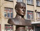
DEZHNEV SEMYON IVANOVICH (c. 1605 - 1673)
Russian polar sailor.
S.I. Dezhnev was probably born in Veliky Ustyug. In the early 1940s he went to Siberia and with a detachment of Cossacks he ended up in Yakutsk, from where he made long trips to the rivers Yana, Kolyma, etc .; sailed by sea from the mouth of the Kolyma to the mouth of the Lena River. But he was especially attracted to the Anadyr River, where, according to rumors, there were many walrus tusks. The Cossacks more than once tried to go by sea to Anadyr, but the harsh ocean met people with impenetrable ice. The first attempt, made by Dezhnev's detachment in the summer of 1647, ended in failure.
In June 1648, a detachment under the command of S.I. Dezhnev decided to repeat his last year's path. At first, the voyage was successful, but beyond Shelagsky Cape, sailors got into a severe storm, two kochas (small ships) were washed ashore. The remaining five ships managed to reach the cape, later named after Dezhnev.
The sailors made their next stop at the Chukchi Cape, but the Chukchi met the sailors unfriendly. Then on September 20 they went to sea and again fell into a storm. The ships were scattered in the roaring sea. The ship on which Dezhnev was on October 1 was thrown ashore in the region of Olyutorsky Bay. 25 people went ashore. Soon they set off in search of the Anadyr River. On the way there, half of the explorers died, and only 13 people reached the mouth of the Anadyr.
At the mouth of the Anadyr River, S.I. Dezhnev founded a prison, where he lived for 10 years. Not far from this place, he found a scythe studded with walrus tusks. Twice S.I. Dezhnev traveled to Moscow to deliver furs and tuskswalrus. During his first stay there, in 1665, he was "turned over for blood and wounds" to chieftains and appointed clerk in Olenyok. During the second journey, in 1673, he fell ill and died.
Dezhnev's main merit is that he opened the strait between Asia and America; named after him extreme point Eurasia on the Chukotka Peninsula - Cape Dezhnev; a ridge in Chukotka, a bay on the coast of the Bering Sea.
Przhevalsky Nikolai Mikhailovich
(1839-1888) - Russian traveler who participated in the exploration of Central Asia.
At the age of sixteen, after graduating from high school, N.M. Przhevalsky volunteered for military service, and after 6 years he was enrolled as a student at the Academy of the General Staff. Having brilliantly finished it, the young officer began to teach geography and history at the Warsaw Junker School. All free time he was preparing for travel: he studied botany, zoology, and compiled herbariums.
His first trip was toUssuri region,where he studied nature and population. Przhevalsky saw amazing places. After all, no step, no look - everything is new, unusual. A northern spruce stands entwined with southern grapes, like a New Year's garland, a mighty Siberian cedar is next to a cork tree, a sable darts in search of prey, and a tiger immediately hunts - this can only be seen in the Ussuri taiga. N.M. Przhevalsky spoke about the results of his expedition in a book-report. During the journey, he collected the richest collection of plants and animals. It was very difficult to keep it: either it rained on the neck in the taiga day and night and moisture penetrated everywhere, or it was cold, it hindered movements, not letting go far from the fire.
After a successful Ussuri journey, Russian Geographic Society sends N.M. Przhevalsky to Central Asia. From 1867 to 1888, he led five large expeditions, during which 33 thousand km were covered. the giant ridge Ti-Altyn-Tag, the northern outskirts of the Tibetan Plateau, was discovered. Przhevalsky himself later described the difficulties of the route: giant mountains, frosts, storms, snowfall, which not only blinded the eyes of travelers, but also hid the sparse vegetation - food for camels. And yet, no matter how difficult it was, not for a day did not stop scientific work: weather observations were made, maps were made, heights were determined, rare plants were collected, calendars were compiled.
Przhevalsky was the first of the scientists to visit Lake Lobnor. Geographers have been tormented by the mystery of this lake for centuries. They knew about him only by hearsay. It turned out that it was located in the desert lands, where the Tarim River was losing strength and spread widely over the sands. Lopnor turned out to be a shallow lake, on the banks of which nomads lived. If you look for a lake modern maps, then it may not be found. In the hundred years that have passed since then, the lake has migrated a hundred kilometers to the north and has become even larger. This happens because the Tarim River, unable to fight the desert, changes its course, flows in a different way and overflows in a new place.
In his studies of Central Asia, N.M. Przhevalsky visited both the sources of the Huang He and the upper reaches of the Yangtze, passed through the sandy Takla-Makan desert. At the beginning of the fifth expedition on the shores of Lake Issyk-Kul in 1888, Przhevalsky died of typhoid fever. The city where this happened is now called Przhevalsk.
The expeditions of N.M. Przhevalsky were of great importance and enriched science with knowledge about the regions of Central Asia by discovering, describing and mapping many ridges of Asia, rich collections of flora and fauna. He discovered in Asia a wild camel and a wild horse, previously unknown. From his companions, Przhevalsky brought up major researchers (M.P. Pevtsov, P.K. Kozlov, etc.). The works of the scientist were published in many languages.
Many geographical objects are named after the Russian traveler.
SEMENOV-TIAN-SHANSKY PETER PETROVICH
(1827-1914) - Russian geographer, zoologist, statistician, public and statesman, one of the largest travelers of the mid-19th - early 20th centuries.
The Russian Geographical Society offered P.P. Semenov to translate the work of the German geographer K. Ritter "Geography of Asia". As he worked on the translation, his interest in the endless expanses of Asia flared up more and more. He was attracted by the then unexplored Tien Shan. European explorers have long been planning a trip to the Tien Shan. dreamed about it and great Alexander Humboldt. But in the middle of the 19th century, little was known about the Tien Shan mountain range (in Chinese - “Heavenly Mountains”), it was even assumed that these were mountains of volcanic origin.
Young P.P. Semenov, who studied at the University of Berlin in 1853-1854, shared with A. Humboldtwith his project of organizing a trip there. 27-year-old Semyonov was already quite well known in scientific circles: he made a great trip across European Russia, was the secretary of the department of physical geography of the Russian Geographical Society. A conversation with A. Humboldt finally strengthened him in his decision to go to the Heavenly Mountains.
The expedition required careful preparation, and only in the autumn of 1856 did Semyonov and his companions reach the shores of Lake Issyk-Kul. Thanks to this expedition, it was established that this lake is drainless (it was previously believed that the river, Chu, flows out of this lake). Research has made it possible to map its exact outlines. The following year, on June 21, 1857, P.P. Semenov with a large detachment set off on an unexplored path along the Tien Shan. This expedition, perhaps, was unique in the entire history of geographical discoveries. It lasted less than three months, but its results are truly amazing: 23 mountain passes were surveyed, the heights of 50 peaks were determined, 300 rock samples were collected, insect collections, 1000 plant specimens (many of them were unknown to science), described in detail natural areas, two transverse geological sections of the Tien Shan were obtained, which helped a deeper study of geology Central Asia. It was also possible to determine the height of the snow line in the mountains, to refute the idea of A. Humboldt about the volcanic origin of the mountains.
Returning to St. Petersburg, he actively participates in the preparation for publication of a map of European Russia and the Caucasus, edits the fundamental "Geographical and Statistical Dictionary" and writes important articles for it; develops the project of the All-Russian population census (1897), heads the Russian Geographical Society. With the direct participation of P.P. Semenov, many large expeditions were organized and carried out: N.M. Przhevalsky, G.N. Potanin, P.K. Kozlov.
In 1899, the first volume of the multi-volume detailed geographical description of the country “Russia. Complete geographical description of our Fatherland”, in the preparation of which P.P. Semenov and his son took part. Of the planned 22 volumes, only 13 were published, but even in an unfinished form, this fundamental work remains unsurpassed.
In 1906, 50 years have passed since the first trip of P.P. Semenov to the Tien Shan. In a special decree, it was reported that "from now on, he and descending offspring are allowed to continue to be called Semyonov-Tien-Shansky."
He completed his journey as a world famous scientist. More than 60 academies in Europe and Russia have elected Semenov-Tien Shan as its honorary member. His name is immortalized in 11 geographical names in Asia, North America and Svalbard, and one of the peaks of the Mongolian Altai bears the name "Peter Petrovich".
Accidental pneumonia on February 26, 1914 brought the scientist and traveler to the grave.
FERSMAN ALEXANDER EVGENIEVICH
(1883-1945) - a well-known geochemist who devoted his life to discovering the wealth of the bowels, a full member of the Academy of Sciences since 1919.
In 1902, he entered Moscow University, where the famous V.I. Vernadsky, the founder of a new, genetic direction in mineralogy, which revealed the origin of minerals, became his teacher. Since Fersman entered the university, teacher and student have been working together; they create a new science - geochemistry, study the chemical composition of the Earth.
A.E. Fersman devotes his life to revealing the riches of the earth's bowels of his homeland. He seeks to know the laws of occurrence and distribution of minerals in various types of pegmatite bodies, the results of which are reflected in his generalizing classic work - "Pegmatites" (1931).
A.E. Fersman did not conceive of a science divorced from practice. As early as 1917, he took part and was the leader of many expeditions to the Urals, Central Asia and other regions. Under his leadership, since 1920, the study of the Khibiny Mountains began, where a deposit of apatite was discovered - a raw material for obtaining phosphorus fertilizers, which are of great importance in agriculture. On the Kola Peninsula, the scientist also discovered deposits of copper, iron and nickel ores. Since 1924, A.E. Fersman organizes expeditions to the Karakum desert, where he discovers deposits of sulfur in its center, later in 1932 in Kyzylkum he discovers deposits of ores with various rare metals.
Geochemical ideas completely changed the idea of minerals - the riches of Central Asia. Being the scientific director of the Tajik-Pamir expedition, Fersman skillfully directs its detachments, which discover deposits of non-ferrous and rare metals where, as previously thought, they should not be. It is difficult to find a corner in our country where there is no scientist.
AE. Fersman wrote about 700 works. For the development of geochemistry as a science, the four-volume work of the academician "Geochemistry" is of particular importance.