Australia's position in relation to other continents. Australia. Characteristics of the natural zones of the mainland
Physico- geographical position australia
Geography teacher MBOU secondary school No. 7
Leshcheva Olga Valerievna

Australia - the only state on the planet that occupies an entire continent. Its area, together with the island of Tasmania, is 7.7 million square meters. km.
Australia- the smallest in area, the driest and sparsely populated mainland of the Earth. This is the most unique continent. Here, when moving north, it becomes hot, and south - colder. There are many animals and plants that cannot be found on other continents. It is winter here in summer and summer in winter.


In the northeast, the coast of Australia is washed by the waters of the Coral Sea. Here is a unique creation of nature - the Great Barrier Reef.
It is a dense collection of coral islands and reefs. The area of the Great Barrier Reef is 200 thousand square kilometers

1. Determine how the mainland is located relative to the equator, the tropics and the prime meridian.
2. Determine which extreme points of Australia belong to the geographic coordinates:
11° S 143°E
39° S 147°E
26° S 113°E
29° S 153°E

Australia- the driest continent on Earth. It is located in subequatorial, tropical, subtropical climatic zones .


Practical work No. 4
"Comparison of GPs of Australia and Africa"
Comparison Plan
Africa
Position in relation to the equator, tropics, prime meridian
Australia
In what climatic zones is it located.
Which zone covers the largest area?
Oceans surrounding the mainland.
Location relative to other continents
Conclusions:____________________________

Homework:
2) execute practical work No. 4 in notebooks.

Internet resources:
URL:http://www.placefound.ru
URL:http://www.ru.123rf.com
URL:http://www.spb.textbook.ru
URL:http://www.news.rambler.ru
URL:http://www.specnazspn.livejournal.com
URL:http://www.yandex.ru
URL:http://www.900igr.net
Geography teacher MBOU secondary school No. 7, Yartseva Leshcheva Olga Valerievna
The task of the material is to give students a complete picture of Australia: to give an idea of the specifics of the climate, to explain the features of the species diversity of the plant world.
Continent Australia
The geography of Australia is quite unique. This feature is explained by the fact that the state borders absolutely follow the contours of the Australian mainland. The continent is in the southern hemisphere. It is also surprising that the border of Australia is completely the coast of the ocean.
For a complete picture of the physiographic plan for describing the mainland, it is necessary to refer to the table, which describes in detail the natural zones of Australia.
Characteristics of the natural zones of the mainland
The zone of deserts and semi-deserts is the most extensive in area. It is located in the tropical zone. This area is characterized by low rainfall, but high degree their evaporation. This is the poverty of the world flora of continental deserts. Here you can see large crusts of salt that cover great distances.

Rice. 1. Salt crusts.
In the east, the desert and semi-desert zone is replaced by the savanna zone, which is more humid. Here the flora is already much more diverse, although insufficient moisture is felt.
TOP 4 articleswho read along with this
The eastern tip of the continent is represented by a mountain system, which is called the Great Dividing Range. The mountain range is the most important landscape barrier of the mainland.
Between the 15th and 28th degrees of the south latitude lies the zone of evergreen forests, and to the north of the 15th degree the zone of permanently wet forests originates.
Australia is not territorially bordered by any country in the world. The coast of the continent is washed by the Indian Ocean in the south and west and the Pacific Ocean in the east. It is thanks only to the water communication with other countries that Australia has retained its appearance unchanged.
Therefore, the answer to the question: with which countries does Australia border, is obvious.
The islands of Australia are:
- New Guinea;
- Tasmania.
The nearest significant administrative unit to Australia, New Guinea, is cut off from the mainland by five hundred kilometers of water expanses of the Timor Sea.
Mainland Australia is the smallest relative to other continents. Its area is about 7 thousand kilometers, and the length of the coastal territory is only 37 thousand kilometers. If you look at the map, Australia with its outlines is like a haystack slightly crumpled at the top.

Rice. 2. Australia on the map.
Due to the remoteness of the mainland from the main world land, the oldest species of animals have continued to exist here until our time.
In Australian Aboriginal dialect, the word "kangaroo" literally means "I don't understand." However, the first Europeans who visited Australia decided that this was the name of this outlandish animal.
The states of Australia include:
- Queensland;
- Victoria;
- Western Australia;
- South Wales, Tasmania;
- South Australia.
This also includes two continental-type territories: the Northern and Federal capitals.
Geographic location of Australia
The mainland is located in three climatic zones: subequatorial, tropical and subtropical.
The island of Tasmania, which is part of the territory of Australia, the southern part of which is located in the temperate zone.
The northern and eastern coasts of the mainland are washed by the Pacific seas:
- Arafura;
- Coral;
- Tasmanov;
- Timorsky.
The western and southern coasts are washed by the waters of the Indian Ocean. Along the northeast coast of Australia for more than two thousand kilometers. stretches the world's largest coral reef - the Great Barrier Reef.

Rice. 3. Great Barrier Reef.
The place where Australia is located is entirely located in the Southern Hemisphere and is distant from the rest of the continents.
The remoteness factor had a significant impact on the formation of unique flora and fauna. This is the main distinguishing feature of the continent from other territories of the globe.
Australia's importance in the global economy can be summed up in its exports. The main export items are agricultural products, mineral raw materials, products of the chemical and manufacturing industries.
Financial and economic support to the state is provided by countries such as Japan and the United States.
Topic quiz
Report Evaluation
Average rating: 4.6. Total ratings received: 268.
Among all other continents, Australia stands out in particular. This is a unique continent in which a unique plant and animal world. In Australia, there are a lot of endemics, that is, plants and animals that live only there and nowhere else in the world. Such features of Australia are explained by its isolation from other continents.
How is Australia located?
To find out how Australia is located relative to other continents, it is necessary to consider the position of all continents. You can do this in the following way:
- Eurasia is entirely located in the northern hemisphere. Meanwhile, Australia is entirely in the southern hemisphere. Thus, Eurasia is located to the north of Australia. They are separated from each other by about a thousand kilometers. After all, the southern tip of Malaysia with Singapore is located near Australia;
- North and South America are washed by the waters of the Pacific Ocean on the western side. Australia is also located in its water area. In fact, the coast of South America is several thousand kilometers west of Australia;
- Africa is located west of Australia. If you sail to the west, then the traveler will get to the eastern coast of Africa. At the same time, it will fall into the waters of the Indian Ocean. He will have to overcome huge spaces - sail past Indonesia, get into the Indian Ocean and move due west;
- Antarctica is located south of Australia. Beyond the warm waters of Australia, the cold waters of Antarctica begin. The further south, the colder it will become, because the movement to the south is the approach to the South Pole.
Thus, Australia is removed from the rest of the continents. This is its main feature.
What is the specificity of Australia
Australia is home to many exotic animals that are not found anywhere else. For example, kangaroos, marsupial rats and so on. The platypus also lives only in Australia. And not far from Australia, in acute Tasmania, the Tasmanian devil lives - another endemic species belonging to endangered animals.
WRITTEN TEACHER'S WORK,
CERTIFIED FOR THE PURPOSE OF ESTABLISHING COMPLIANCE WITH THE POST
MBOU "Secondary School No. 1", Bologoye, Tver Region, 2014
Ivanova Svetlana Nikolaevna, teacher of geography
Geography Lesson #32
in the 7th grade
Theme: “Australia. The geographical position of the mainland, the history of discovery and research "
Date of passing the qualification test ______________________
Place of test ______________________________________
The form of the test - full-time, writing a summary training session.
Educational:
to give students an idea of the geographical location of mainland Australia, to activate the terms and concepts for the study of mainland Australia, to study the history of the study of the mainland, to consolidate the material received in the lesson, to continue the formation of skills to work with a map, atlas, contour maps.
Developing: instill interest in new knowledge, improve analysis skills educational material, develop attention, thinking, memory.
Educational: to form a positive attitude in the group, the ability to listen to comrades, to express their opinion.
Equipment: physical map of Australia, maps of atlases and contour maps, presentation of the lesson "Australia", video lesson Australia, reference cards for group work.
Musical accompaniment: physical education song about the continents.
Student helpers: students of the same class are preparing a differentiated homework in the form of messages about the discoverers of mainland Australia.
The course of the lesson:
Organizing time:
Screensaver on an interactive whiteboard with the beauties of mainland Australia(slide number 1)
A video about mainland Australia appears on the interactive whiteboard(slide number 2), a poem about the mainland is read:
unusual continent,
Although small in stature.
marsupial animals
Lots of people live here.
Squirrels, rats, kangaroos
And a koala bear.
Here is an echidna, a platypus -
Only meet here
Parrots, lyrebird
They swing on the branches.
Students are invited to determine the objectives of the lesson
I. Motivational-objective function:
1. Statement of the training session (what specific result should we get at the end of the training session)
- get acquainted with the physical and geographical position of the mainland;
- to study the history of the discovery and exploration of the mainland of Australia.
2. Motivation:
Why do we need to know this material:
- Continue to develop the ability to work with geographical maps, the text of the textbook;
- to name and show the names and routes of travelers and researchers, all the objects of the coastline being studied.
II. Information and analytical part:
A series of questions appear on the interactive whiteboard for students to answer.(slide number 3)
What is a mainland? (The vast expanse of the earth, washed by the seas and oceans, land.)
- how many continents are on the planet? Name them? (6, Africa, Australia, Eurasia, Antarctica, North America, South America)
How is a mainland different from an island?The continents appeared in one way, separated from one plate that rose above the oceans. Islands are formed by four different ways. There are only six continents and countless islands on the planet. All continents are much larger than any of the islands. All continents are inhabited by people, in contrast to the islands, many of which have not been set foot by a person. All continents have been known to mankind for more than a hundred years, and many islands still remain unexplored. Continents occupy 94% of the planet's land mass, and all the islands - no more than
Can you name the continent we will study? (Yes, Australia)
Why do we call it the southern mainland ? (It is located entirely at the south pole)
Where can I get information about the mainland ? (maps, atlases, textbooks, internet)
The topic of the lesson appears on the interactive whiteboard: “Australia. The geographical position of the mainland, the history of discovery and research ", the last lines of the poem are read:(slide number 4)
We will cross the Indian Ocean
And then we will immediately get to Australia.
III. Planned and predictive:
1. Conversation:
- (slide number 5)Listen to an excerpt from J. Verne's book "The Children of Captain Grant" and find out whether the words of the hero of Paganel's work are true or fiction? (Audiobook entry appears)
-
Do you agree with the history of the formation of the mainland?(No, it's part of Gondwana
).
I wonder what ways you can get to mainland Australia?
2. Work in groups with reference cards: (slide number 6)
When working in groups, the cards have a reference card, and reference words:
1 group:“To trace the path from Moscow to Australia, you need to turn the globe half a turn. A traveler who planned to overcome this distance 100-200 years ago would need from 7 months to 1 year.
2 group: Nowadays, from Moscow to Sydney on a jet liner you fly in 40 hours.
At 17 o'clock you get on a plane in Moscow at the Sheremetyevsky airfield. In the dead of night, the plane is landing in Delhi, a short stop, and at 11 am local time the next day, in Singapore. At 8 pm landing again and another sleepless night. At the bottom of the islands of the Indian Ocean, Indonesia and, finally, with the dawn of Australia. For a long, long time we fly over the deserts. And only in the morning we land in the largest city in Australia, Sydney.
Australians love their country very much and always ask tourists the question: “How do you like Australia?”.
Intermediate result: determine the preliminary level of knowledge when working in a group (max. 10 points).
3. Research activities by slides:
The area of Australia, the smallest continent of the Earth, is 7631.5 thousand km 2.
Australia is a real record holder in many geographical characteristics. Slides about the uniqueness of mainland Australia appear on the interactive whiteboard:
Students themselves, using a map and an atlas, should identify the features of the mainland (slide number 7)
The "lowest" continent:
Only 2% of Australia's territory is above 1000 m, and the highest peak, Mount Kosciuszko in South Wales, rises only 2228 m. The lowest point, Eyre Salt Lake, is 16 m below sea level.
Hottest continent:
2/3 are occupied by deserts and semi-deserts. In summer, in the Simson Desert, the temperature reaches +60 0
With in the shade.
The driest continent:
On average, 240 ml of precipitation falls here annually. This is 8 times less than in South America, and 5 times less than in Africa.
Continent poorest in rivers:
The annual flow of all rivers in Australia is 350 km3, which is 2 times less than the annual flow of the Yenisei.
The most reserved continent:
Of the 12 thousand plant species, more than 9 thousand are not found anywhere. The same applies to 9/10 animal species.
The Commonwealth of Australia is the only state in the world that occupies the territory of an entire continent.
Intermediate result: determine the preliminary level of knowledge about the uniqueness of the mainland (max. 10 points).
What did you find particularly interesting? (student answers)
4. Working with a map, interactive whiteboard, atlases:
Interactive whiteboard shows questions for students to answer (slide 8)
Geographic location of the mainland.
How is the continent located relative to the equator?
How is the continent located relative to the prime meridian?
How is the mainland relative to the tropics?
In what climate zones is the mainland located?
What oceans and seas surround Australia?
How is Australia located in relation to other continents? Which continents are close and which are distant?
–determine the geographical coordinates (slide 8)
Name extreme point
Latitude
Longitude
Northern
Cape York
10 0 S
South
Cape Southeast
39 0 S
Western
Cape Steep Point
113 0 east
Eastern
Cape Byron
153 0 east
Make calculations: 1 row - the length of the mainland from north to south
2 row - from west to east. (slide 9)
Intermediate result, determine the preliminary level of knowledge about the physical and geographical position of the mainland Australia (max. 10 points)
Reflection:
- let's check how you completed the task, the slides contain information about the objects that you now need to know and show (slide 10)
Seas: Arafura, Coral, Tasmanovo, Timor.
Bays: Carpentaria, Great Australian.
Straits: Torres, Basov.
Islands: New Guinea, New Zealand, Tasmania, Great Barrier Reef.
Peninsulas: Arnhemland, Cape York, Eyre.
f) Solving a logical problem.
Why do you think the discovery of the mainland began from the north, south and southeast coast, and not from the east? ( on the way was the Great Barrier Reef)
5. Physical education minute(song about the continents)
6. Individual reports of students based on differentiated homework:
Students are preparing a message at home about the discoverers of mainland Australia
Student answers (homework):
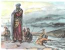
In the XVI century. cartographers depicted on maps and globes in the southern hemisphere a huge “Unknown South Land". Discovered by Magellan Tierra del Fuego” was considered one of the protrusions of this “Unknown South Land”, and the northern shores of the island of New Guinea were represented by its other Section.
In 1606, the Spaniard Torres discovered the northernmost tip of the Australian Cape York Peninsula, and called the strait separating New Guinea from Cape York, called Torres. When Torres informed the Spanish authorities in the Philippines about his discovery, it was decided to keep this discovery a secret, and for over 150 years no one knew about it. Only after the capture of Manila did the British find Torres' message in the archives. It was published only after James Cook in the 18th century. passed the strait between Australia and New Guinea for the second time. Almost at the same time as Torres, the Dutch navigator Janszon also saw the northern coast of Australia, entering the Gulf of Carpentaria.
In the first half of the XVII century. the Dutch discovered the northern, western and part of the southern coast of Australia, which until early XIX in. called New Holland. This land mass was first declared part of the South Land, but in 1642-1643. The Dutchman Tasman, bypassing New Holland along the circular route, proved that it is a special continent. Tasman did not see the eastern shores, as he walked too far from them, but he discovered a section of the coast of New Zealand.
In the XVIII century. between England and France began a rivalry for the championship of the discovery of a new continent.
In the summer of 1768, an expedition set off from the coast of England in search of a new continent on the ship “Endeavor” (“Attempt”) under the command of the already well-known navigator James Cook by that time. In the instructions that Cook received before leaving for the voyage, he was ordered to search for the southern mainland from the coast of Tahiti to 40 ° S. sh. If the continent was not discovered, Cook was asked to go in search of it to the west, following between 40 ° and 35 ° S. sh. until the expedition discovers it or reaches the eastern shore of the land discovered by Tasman.
In October 1769, the Endeavor spotted land on the horizon. It was the New Zealand coast. Here Cook determined that New Zealand represented two islands. Thus, the research program was completed.
Return journey James Cook suggested passing through the Cape of Good Hope, heading west. April 1, 1770 Endeavor headed west, and on April 19 the expedition reached the east coast of Australia at the southernmost tip. April 28 at 34°S sh. The first landing on the coast took place. A small group of dark-skinned natives, at the sight of the aliens, hid in the forest. On April 29, a large bay was discovered. The area around was wonderful: a dense forest grew on the shore, the air in it was surprisingly fresh, and the strong resinous smell slightly dizzy. The trees in this forest were eucalyptus, and the bay was named Botanical.
Until the end of May, the ship sailed along the central section of the east coast. At the end of May, Endeavor entered the dangerous zone of coral reefs and shoals. Here the ship ran aground and ripped open the bottom. At the mouth of the river (it was called Endeavour) had to stop for repairs. The Endeavor moved very slowly through the reefs and shallows that Cook called the Labyrinth. A passage was found in the reefs, which Cook called the pass of Providence. Following this narrow strait, on August 21, 1770, the expedition reached the northern tip of the fifth continent, to which Cook named Cape York. The next day, Cook entered the strait separating Australia from New Guinea.
On August 22, 1770, Cook landed on a small island in the Torres Strait and brought the entire east coast of New Holland, which he called New South Wales, into the possession of the British crown.
Filling in the table using an atlas and a textbook and students' stories (slide No. 11, 12)
Travelers and explorers
Travel and exploration dates
Discoveries and research results
Willem Janszon
Dutchman
north coast australia
Gulf of Carpentaria
L. Torres
Hispanic
Torres Strait
Cape York Peninsula
Abel Tasman
Dutchman
tasmania island
New Zealand coast
James Cook
Englishman
East Coast

IV. Control and diagnostic stage:
Students are offered testing with multiple choice answers in the form of the OGE
(slide number 13)
1. Which statements about the geographical position of Australia are true?
1) The equator crosses Australia in the northern part,
2) Australia lies entirely in the Western Hemisphere,
3) In the east, the mainland is washed by the waters of the Pacific Ocean,
4) southern tropic crosses Australia almost in the middle.
2. Which two islands are closest to the coast of Australia?
1) New Guinea, 2) New Zealand, 3) Tasmania, 4) Kalimantan.
3. In what sea is the Great Barrier Reef located?
1) Tasmanovo, 2) Fiji, 3) Arafura, 4) Coral.
4. The extreme eastern point of mainland Australia:
1) Cape Byron;
2) Cape South East Point;
3) Cape York.
5. Mainland Australia was opened:
1) J. Cook;
2) F. Magellan;
3. N.N. Miklouho-Maclay.
Answers: 1 - 3.4; 2 -1.3; 3-4; 4 - 1; 5 - 1;
Reflection:
Summing up the lesson, checking testing (max - 5 points)
Differentiated homework: (slide number 14)
Mark "4":
Mark "5":
§35 paraphrase; questions after pr. orally;
creative work"Crossword "Australia".
Introspection:
Training session “Australia. The geographical position of the mainland, the history of discovery and research. The purpose of the lesson is to give students an idea of the geographical position of the mainland Australia, to activate the terms and concepts for the study of mainland Australia, to study the history of the study of the mainland, to consolidate the material received in the lesson, to continue the formation of skills to work with a map, atlas, contour maps.
The tasks that were solved in this lesson were implemented. Students fully showed activity (in answering questions, engaging in discussion of problems), enthusiasm new topic, interest in getting more information. They were able to show their independence in the ability to work with information (in the selection of literature, identifying the main thoughts of the statement), expressing their own opinion. The logic of the lesson, the change of tasks, a friendly educational environment made it possible to avoid overloading students.
The type of training session is combined, including the following steps: Organizing time, preparing students for the upcoming work, practical part, summing up the results of the work, evaluating the activities of students, information about homework.
In the lesson, individual and frontal forms of work were used.
The solution of the set tasks was facilitated by the use of the necessary technical means, demonstration aids and materials: a multimedia projector, maps, reference cards.
The lesson showed that the children understood the material well, showed a keen interest in the further study of the mainland Australia.
The set goals of the training session were achieved.
Australia is the smallest and most amazing continent. Australia was discovered later than America. The entire mainland is occupied by one state - the Commonwealth of Australia. The Australian continent is the flattest of all continents and the driest. One of the features of the nature of the continent is the absence of young mountains, glaciers and active volcanoes on it. Australia earlier than other continents, about 150 million years ago, separated from Gondwana and quickly moved away from its other blocks. Because of this, it has an exceptionally peculiar nature. The mainland is justifiably called the "museum of living fossils."
Geographical position
Australia is located entirely in the Southern and Eastern Hemispheres. Almost in the middle of it crosses the Southern Tropic. Australia is a separate continent, remote from other continents. This is what determined the uniqueness of its nature. The main trade routes pass away from the mainland, which makes it difficult to develop economic ties. (Which islands are the "bridge" between Australia and Southeast Asia?)
The area of Australia is 7.6 million km2. The shores of the mainland are slightly indented. In the north it juts out into the land Gulf of Carpentaria, on South - Great Australian Bight. The northern edge of the mainland forms Cape York Peninsula. On the southeastern coast is tasmania island, near the northeast - one of the large islands of Oceania - island of new guinea separated from Australia Torres Strait.
Warm waters washing the mainland and shallow depths contribute to the formation and growth of coral reefs off the coast. They are formed as a result of the vital activity of marine organisms with a calcareous skeleton, mainly coral polyps. In the Pacific Ocean, along the eastern coast of Australia, a long ridge of coral formations stretches for about 2500 km - Great Barrier Reef.
Discovery and exploration of Australia
The Dutch navigator Willem Janszoon was the first European to reach the coast of Australia in 1606. During the Great geographical discoveries Dutchman Abel Tasman explored the northern and northwestern coasts of Australia. In the XVIII century. Englishman James Cook rediscovered Australia and the islands of New Zealand and declared them colonies of England.
For several decades, convicts for various crimes were expelled to Australia from England. They developed new territories, engaged in mining, animal husbandry.
Rice. 61. E. Eyre

Rice. 62. J. Stewart
In 1840, the sheep breeder Edward Eyre (Fig. 61) intended to explore the space between the Flinders Ridge and west coast(area of Perth city) in South Australia. E. Air could not go deep into the mainland, he explored only the southern coast.
In honor of E. Eyre, the largest lake on the mainland was named. During a four-month journey, E. Eyre covered over 2000 km.
The central deserts were explored by the British Robert Burke and John Stewart (Fig. 62). To late XIX in. exploration of the interior of Australia was largely completed. (Trace the routes of the explorers of Australia on the map of the atlas.)
Geological structure, relief, minerals
The surface of Australia is predominantly flat and the lowest compared to other continents. Its average absolute height is only 350 m. The base of the mainland is an ancient Australian platform, part of the Indo-Australian lithospheric plate. The platform occupies the western and central parts of the mainland. The crystalline foundation of the platform is composed of ancient rocks. In the west, the foundation comes to the surface, forming shields.
The western part of the Australian Platform is uplifted. Here is the vast Western Australian plateau 400-600 m high. The flat surface in the center of the mainland is disturbed by massifs - remnants of rocks. The remains of a plateau with steep slopes and flat tops have a height of 400-600 m. Stony and sandy deserts predominate (Bolshaya Peschanaya, Great Victoria Desert).
The eastern part of the platform is a huge trough, covered with a thick layer of predominantly marine sediments. Absolute heights Central lowlands do not exceed 100 m. The lowest point of the mainland is located in the area of \u200b\u200bEyre North Lake (16 m below sea level). To the south is the Flinders Ridge.
A folded belt, the East Australian Mountains, adjoins the Australian Platform in the east. Great Dividing Range stretches along the east and southeast coast of Australia. The highest part of the ridge australian alps- bear traces of ancient glaciation. The highest point of the mountains and the mainland Kosciuszko(2230 m).
Australia is the flattest continent with a leveled relief and the most tectonically stable continent: there are no volcanoes, young mountains and modern glaciation.
Minerals
The Australian platform contains large reserves of gold, platinum, uranium, iron, copper, lead-zinc ores and tin. Deposits of phosphorites, hard and brown coal, oil and natural gas. Many minerals
(bauxite, iron ore) occur at shallow depths and are mined in an open and cheap way. Oil, gas and coal deposits are confined to depressions and deflections of the platform.
Australia ranks first in the world in the extraction of bauxite, zinc, diamonds, second in the extraction of iron ore, uranium and lead, and third in the extraction of nickel and gold (Fig. 63). Australia has a quarter of the uranium reserves of the developed countries of the world, and a third of all diamonds on the planet are mined. gold is mined

Rice. 63. In Western Australia
At the beginning of the XXI century. The Australian Diamond Mining Union overtook the leading countries of the world: the Democratic Republic of the Congo, South Africa, Angola. Local diamonds are considered unique due to their rare pinkish hue.
Bibliography
1. Geography grade 8. Tutorial for the 8th grade of institutions of general secondary education with the Russian language of instruction / Edited by Professor P. S. Lopukh - Minsk "Narodnaya Asveta" 2014