Mysterious ancient structures in the Siberian tundra. Why is there no relict forest in Siberia? Average age of trees in Russia
Very interesting material sent by the author himself for our site.
"Hello, dear readers. I ask you to excuse me in advance for some confusion in my presentation and possible mistakes, for the simple reason that writing this article is my first literary experience. So, allow me to introduce myself. My name is Kirill Kolonskikh and I have been working for more than 10 years On a rotational basis at the gas production company Gazprom Dobycha Yamburg LLC, I currently hold the position of category 1 oil and gas production engineer at the northernmost field of the enterprise.
This small introduction is necessary only so that you have an understanding of the fact that I know quite well and were not immediately questioned by you, those facts and concepts with which I will operate in the future.
And now I will move directly to the presentation of the events that took place. April 14, 2012 shift flight GZP 421 YAMBURG-UFA. I, in the company of other happy and satisfied shift workers who had honestly worked their shifts and were leaving for inter-shift rest at their places of permanent residence, having stood in line for registration, noted with some satisfaction that the ticket I received this time was near the window. And there is a completely logical explanation for this fact; those who have flown on the TU-154 should remember that in this excellent aircraft in all respects, except for the convenience of accommodating passengers, the row consists of 3 seats, and given the build of the tough men working in the Arctic Circle, at least with With the illusion of comfort, you can sit either in the aisle or near the porthole.
What followed was a series of coincidences that led to me being able to take the photographs below. First of all, after takeoff, I noticed the fact that the sky was surprisingly cloudless. As I wrote earlier, I have been flying to and from work for over 10 years, but I have never witnessed such amazing visibility. Usually, after takeoff, the plane flies through cirrus clouds in the upper layers of the atmosphere while climbing, and most of the time from below you can only see endless snow wool from horizon to horizon.
Clouds in the upper layers of the atmosphere, however, can sometimes have a more rarefied structure, but a feature of northern latitudes is also high cloudiness in the lower layers of the atmosphere, which completely hides any visibility. So this time the visibility was so good that I completely forgot about the most favorite entertainment of shift workers on the plane, (don’t think anything bad, I mean sleep) pressed my nose to the window and, armed with a smartphone with a built-in camera, enjoyed the harsh northern beauty and occasionally I photographed something most interesting.
I would like to talk about northern beauty separately. I, as a person born and raised in central Russia, did not immediately grasp all the beauty and charm of this amazing region. But over time, this nature was absorbed into me and became part of me, I can say with full confidence that the north of the country has its own special but no less wonderful nature, even if it is not so expressive and does not shine with a variety of colors, but it is magnificent with its insignificant details and strokes. She's just beautiful. Ugh, okay, forgive me for this little digression, I just couldn’t resist. I'll start posting photos:
Fig.1 One of the hydrocarbon production facilities.
To view full size, click on the photo

Considering that the photographs were originally taken with a smartphone camera, which naturally does not indicate the best quality of the images, you can catch the main points. I will post a number of photographs only so that you can see how some man-made objects look from an airplane, in order to understand how strikingly they differ from the photographs that will actually show those fragments that amazed me. For example, in this photograph you can clearly see laid roads and pipelines. We follow further:
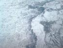
Fig.2 Just an amazingly beautiful bend of some northern river

Rice. 3 New Urengoy-Surgut highway

It’s just wonderful that before we flew over the amazing lines visible in the following photographs, I had the opportunity to photograph the road so that I could understand the huge difference in the technologies for constructing these engineering solutions.
Fig. 4. Three absolutely parallel lines are clearly visible even in the tundra.

In order to clearly see the lines, you need to look at photographs with a large expansion, in order to increase their visibility in this article, I’m in Power Point, I just drew lines next to them in a clearly visible red color . This was the first thing I saw and probably would not have paid special attention to it and might even have thought that these were just nearby collectors of the main gas pipeline. This is the first thing that came to my mind. But looking at the fact that we were flying further, I generally felt a sense of unreality of what was happening.

Fig. 5. The number of parallel lines increased to five, and this is what finally finished me off - another similar line intersecting them at right angles!

With red underline

Fig 6. Here everything has already fallen into place; something really exists. Here, clear, absolutely geometrically regular rectangles are already quite amenable to observation.
The photo is darkened and without red underlines.

With red underline

Naturally, I could not remain indifferent to what I saw and asked my colleagues and neighbors on the plane to look out the window and make sure that I really was not suffering from hallucinations. Although hallucinations are of course difficult to capture with a camera. And my powerful but not so curious comrades-in-arms confirmed that they say we see some kind of sh...y, but it’s not very interesting to us and in general we want to sleep and there are more important things to do in this world - they’re already serving lunch.
The first thing that came to my mind was the film “The Thirteenth Floor”, I hope you have watched this amazing film about artificial reality, a kind of analogue of “The Matrix”. So there is a moment when one of the heroes decides to leave the boundaries of his world and discovers that his world is finite and it is limited by these computer straight lines.
But I’m still too much of a materialist and an engineer to the core for this, so I reject these considerations and accept the following hypothesis. These are certainly unique engineering structures. Who is their builder and for what purpose they were built, I am afraid, will remain a mystery for a very long time.
Why unique? Well, firstly, even with the modern level of instrumentation, this is the incredible geometric correctness and simply cyclopean nature of the structures. Secondly, it is one thing to mark it geometrically correctly, but quite another to construct it correctly. As you know, building such huge straight lines is very energy and material intensive. Let's take roads for example. The shortest distance between two points is a straight line, everyone knows that.
Has anyone seen absolutely straight roads anywhere? A very rare occurrence. This leads to the following conclusion: the unknown builders fundamentally needed such an arrangement of these objects. Thirdly, the very fact of construction in the tundra. The construction of any structures in the tundra is a priori a difficult task, associated with the low bearing capacity of the soil, which is permafrost. The only technology currently available for constructing foundations is the immersion of simply huge piles into permafrost.
This is a very complex engineering task, and also very financially expensive. And then the never-ending struggle with the thermal stabilization of these piles and the struggle with their bulging out of the ground. This is a completely separate song. In general, without supervision, any building in an MMP environment will be destroyed over time. This suggests the following conclusion that these structures are very old, and that they appeared through the tundra as a result of soil erosion. And they were built long before the Ice Age, when these latitudes had a completely different climate.
I really want to believe that this fact will not go unnoticed by interested parties and these structures will be thoroughly investigated. I am more than sure that by examining these structures, we will receive a lot of evidence of the existence in ancient times of a highly developed civilization of our ancestors on the territory of Western Siberia.
Thank you for attention.
material taken from the site "sport club Klumba".... At first glance, such ordinary quarterly clearings in Russian forests, if you think about it, are not so simple and raise a lot of questions, both about their origin and about how they are maintained without becoming overgrown for decades. But the scientific discovery made by oil engineer Kirill Kolonskikh comes as a real shock. It turned out that only the forests of Russia are delineated by “clearings”, but also... the Yamal tundra! I will quote from his message only some of the photographs and some conclusions drawn by the author. Next to the white “clearings” the author drew red lines (click to enlarge) to make them more noticeable, I used another method: I increased the contrast of the image in the graphics editor, here is a fragment of the resulting image:
The lines became more clearly defined. This is how the author describes the event of his discovery: “Naturally, I could not remain indifferent to what I saw and asked my colleagues and neighbors on the plane to look out the window and make sure that I was really not suffering from hallucinations. Although hallucinations are of course difficult to photograph with a camera. And my powerful but not so curious comrades-in-arms confirmed, yes, they say we see some kind of sh... y, but it’s not very interesting to us and in general we want to sleep and there are more important things to do in this world - they’re already delivering lunch. The first thing that came to my mind. this is the film “The Thirteenth Floor”, I hope you have watched this amazing film, about artificial reality, a kind of analogue of “The Matrix”. straight lines. But I’m still too much of a materialist and an engineer to the core for this, so I reject these considerations and accept the following hypothesis. These are certainly unique engineering structures. Who is their builder and for what purpose they were built, I am afraid, will remain a mystery for a very long time. Why unique? Well, firstly, even with the modern level of instrumentation, this is the incredible geometric correctness and simply cyclopean nature of the structures. Secondly, it is one thing to mark it geometrically correctly, but quite another to construct it correctly. As you know, building such huge straight lines is very energy and material intensive. Let's take roads for example. The shortest distance between two points is a straight line, everyone knows that. Has anyone seen absolutely straight roads anywhere? A very rare occurrence. This leads to the following conclusion: the unknown builders fundamentally needed such an arrangement of these objects. Thirdly, the very fact of construction in the tundra. The construction of any structures in the tundra is a priori a difficult task, associated with the low bearing capacity of the soil, which is permafrost. The only technology currently available for constructing foundations is the immersion of simply huge piles into permafrost. This is a very complex engineering task, and also very financially expensive. And then the never-ending struggle with the thermal stabilization of these piles and the struggle with their bulging out of the ground. This is a completely separate song. In general, without supervision, any building in an MMP environment will be destroyed over time. This suggests the following conclusion that these structures are very old, and that they appeared through the tundra as a result of soil erosion. And they were built long before the Ice Age, when these latitudes had a completely different climate. I really want to believe that this fact will not go unnoticed by interested parties and these structures will be thoroughly investigated. I am more than sure that by examining these structures, we will receive a lot of evidence of the existence in ancient times on the territory of Western Siberia of a highly developed civilization of our ancestors." The author is naive: his discovery contradicts "science", and therefore it will be completely indifferent to him, but he is right in the main thing: to attribute the drawing of these lines to the Khanty-Mansi and other Eskimos is absolute stupidity; only a developed civilization, or the Great Architect (in whose existence the author does not believe) could have done this. The presence of such “markings” casts doubt on the authorship of some “ancient Egyptians.” from school textbooks, to the construction of Egyptian pyramids - these guys are not very far ahead in their capabilities from the Eskimos. It is equally stupid to attribute Machu Picchu to the Aztecs and Incas. As for the clearings and some other geoglyphs, here are some more materials from another Internet researcher. Kazakhstan, on the resort lake Borovoye. There is a forest growing around the lake, but it is unlikely that the Russian tsars ever opened forestry areas there, and clearings in Russian versts turned out to be there too!
“The surprising thing is that even the forest is not able to absorb these lines. Trees grow everywhere, even in the “clearings” themselves, but from the air the lines are clearly visible, and the sides of each block are equal to one Russian verst. After 1918, the old one was not used anywhere in Russia Russian system of weights and measures. This suggests that even if we assume that the neighborhoods were developed by pre-revolutionary foresters, the question of why these lines are still not completely overgrown remains unanswered." - writes the researcher.
“Trying to expand the volume of information about megaliths on the territory of the former USSR, I happen to encounter the most curious objects. This geoglyph, which is in the first picture, was discovered in Kazakhstan, not far from Ushtogai in the Kustanai region. I measured it and marveled. The side of the face is fifty meters larger than at the Cheops pyramid in Egypt. I began to look for additional information, it turned out that I was not the first to discover this strange square. After one of the locals, using the same Google, spotted a strange drawing in the steppe, an expedition headed there. enthusiasts in 2007. It was possible to find out that these are mounds, but all of them are empty. This is reassuring, which means that significant results can be achieved even without going to the site, just sitting at home in a comfortable chair!
“I was unable to discover the most important thing: where is at least one intelligible version of the origin and purpose of this geoglyph? Guess three times which version is considered by scientists as the only probable one? I laughed for a long time, because I know from experience that such information need not be verified. There are two options: an observatory of the ancients, or a temple of sun worshipers. These were our ancestors: they did not need to eat or drink, nor did they need to warm themselves or take shelter from the weather. The only thing the ancient people did was pray to idols and cut the throats of captured enemies. sacrificial stone, and in between these entertainments, they stared at the sun and the moon in the stone observatories. For some reason, Kazakh researchers are seriously considering only the second option. Now the question is: what appears in your mind’s eye when you try to identify an object? If someone besides me had the idea that this is a projection on the plane of a three-dimensional figure, a pyramid, then all is not lost. Of course, conducting geodetic surveys before building a pyramid in such a place seems extremely stupid, because all around is bare steppe, no mountains, rocks, or deposits of natural stone. However, in China, the pyramids were also built in the steppe zone and without any stones; they are purely earthen mounds. There are destroyed pyramids, undestroyed ones are also known, but why are there no unfinished ones anywhere? So maybe this is just the case? Was construction frozen at the stage of geodetic work? What could be fantastic about this assumption? But that's not all. People send me links to other mysterious objects. Probably everyone has heard about the Zyuratkul elk?
It is located in the south of the Chelyabinsk region, in the Satka district, near the Zyuratkul national park. It is not clear why almost only specialists and those who are concerned know about it, but every child in any country in the world knows about the drawings on the Nazca plateau in Peru? Not far from Ussuriysk, one of my friends discovered this quite by accident:
It looks like a humanoid creature with wings. And even in a spacesuit, maybe
The comrade, of course, decided that most likely it could have been left by the military, and decided to reconnoiter everything on the ground. The results are in front of you.
“There is no reason to believe that this was done by contemporaries, although, of course, no evidence of the antiquity of the geoglyph can be found. At least not yet. But the object really exists. Could it be that at least one meter of land on the territory of the globe remained within the white spots? I admit this possibility anywhere, but not in a region that is strategically important for Russia. Aerial photography has been carried out regularly since the beginning of the 20th century. Cartographers and military pilots have known about their existence for a long time, but if you open it. all this has to be done again only in the 21st century by amateurs, which means the inevitable conclusion is that there are grounds for hiding information about objects of this kind. WHY?” In general, it is straight lines that are most interesting for research, in my opinion.
“It’s only when you see all these spiders, beetles and cockroaches for the first time that you feel delighted. In fact, over time, the realization inevitably comes that they are made extremely artlessly, just like a child draws his first drawings with his fragile pen. But the lines, yes! This is a very accurate calculation and a huge amount of work. These lines are present almost all over the Earth. They are even used in the capitalist national economy, for example, lines crossing the entire continent, without deviating a meter for hundreds of kilometers, have become free markings for the construction of highways. But all this can be somehow understood and reasonable explanations can be found. It is impossible to understand the following:
Who could furrow the ocean bottom with roads? The fact is that the bottom surface of all oceans is the youngest on the planet. Fractures in the earth's crust between continents are constantly working to change the diameter of the globe, increasing it by 19 cm per year. Therefore, the closer the distance from the coast, the older it is. And no one has ever lived at its bottom or built anything. On the contrary, the level of the world's oceans is constantly falling, and people are settling closer and closer to the water. This issue is not even discussed, no matter what world science says about warming and rising sea levels. Scientists say one thing, but in fact all sensible people are already fully convinced that the world is not threatened by flooding, but rather by dehydration. There has already been a flood on earth, and we are all witnesses to the reverse, post-flood processes, as a result of which the ocean is inexorably becoming shallow. Over 100 years, the level has dropped in some places by 20 meters. And this process is accelerating, so that our great-grandchildren may well witness how only dead salt lakes will remain in place of the oceans. And in an even more distant future, our planet will inevitably face the fate of Mars. But this will not happen, I hope, soon. First we have to witness wars for drinking water. It is simply disappearing at an unimaginable speed, but mind you, world science continues to scare us with global warming, floods and AIDS. But fewer people die from AIDS than from vaccinations. So I warned you. The squealing about rising sea levels is just a red herring. In fact, the threat comes from the rear. Trouble came out of nowhere! And so... Tell me now, who drew the lines on the bottom of the oceans? I don’t know who, but I know that the person has absolutely nothing to do with it. So we can only point to the one who built it all. So, before creating his product, a tinsmith takes a ruler, a core, and draws a pattern on a sheet of iron. Then he makes cuts, bends individual parts at the required angle and... Voila! The bucket is ready, but the lines from the core remain. So, perhaps the lines on the surface of the entire planet are traces of technical creativity? And such phenomena as Yonaguni are also just technical elements of the Earth’s design? Like, for example, reinforcing lathing, which becomes visible if the plaster falls off? My imagination wasn’t enough for more, but how are you doing with this matter?” Additions
When flying from Novy Urengoy to Moscow, for the first half of the journey in deserted areas from a height of 10 km, I observed numerous strange stripes on the ground, many kilometers long, flat, without taking into account the terrain, intersecting at different angles, sometimes parallel... As a builder, I can say that now they are linear objects are not built like that, and in the video at the end he specifically showed what the highway and pipeline look like from above. I can’t say who and for what purposes could make such stripes now, but on the Internet there are articles about strange multi-kilometer-long unovergrown clearings, canals, etc.
There are strange things on earth. Strange and inexplicable, except for some nonsense. Such things include, for example, the so-called “clearings”, of which there are more than 3 million kilometers in Russia alone, according to the most conservative estimates. These clearings were supposedly cut by tsarist lumberjacks and brave Soviet foresters in order to facilitate the difficult task of navigating the terrain and accurately recording state property. Lines, grids and geometric shapes, so easily visible from the air and visible even from space, are measured mainly in miles, but I will give numbers in meters.
In all cases, we can confidently speak about the absolute accuracy of the lines and angles of the clearing patterns. Their width is sometimes fantastic, many are clearly visible from a height of more than 300 kilometers - this is one and a half times further than the orbit of the earth. If the “clearing” is oriented north, then this is the exact direction to the pole; if there is a perpendicular to it, then this is clearly 90 degrees. Another very strange feature is that they do not overgrow.
At this point I stop using the term “clearings” and start calling them simply “lines”, because this is much less far from the truth.
We see these lines everywhere and all the time. Most of our roads and power lines are laid along them, and our holiday villages are built on them. Like in this photo of the area of Noginsk near Moscow.

We see that the lines cut right through populated areas, that they are much larger. To test for straightness, I usually use the edge of a piece of paper against the monitor. The Google Earth program offers tools for more accurate and detailed measurements.
Southeast of Vladimir. Probing the village of Skripino, an ideally straight double line, similar to a trace from a car, has a length of 25 kilometers, without changing straightness. And without taking into account the terrain. It is interesting that on the plain the horizon line is only 4 kilometers away from a person of average height.

Interesting places around Bratsk. In this photograph there is, as it were, the “beginning” of a bunch of lines.

Afterwards from here they will break up into arrows flying in different directions. One or two are used for power lines, the same number for roads, and some area is being built up by the city.
Width -285 meters! Direction - North Pole, deviation no more than 0.05 degrees. A motorway is built nearby along a much narrower line.
And this is a view “from an airplane” 120 km southwest of Bratsk (it must be said - a rare wilderness, judging by the maps): a wide line on the right, the rest of the photo is outlined in narrower stripes, but also with phenomenal accuracy.

Here's another area nearby.
Space-precise marking of the planet's surface was practiced not only on the territory of modern Russia, but also on the rest of the planet, to a greater or lesser extent. There are especially many traces left in North America. All these cyclopean cells of American states are laid along roads, although most Americans believe, of course, that everything is the other way around - roads are laid along state boundaries.
There are a million examples I can give, I will give only the most egregious ones.
Here's a farm in Colorado.

All angles are ideal - 90 degrees, there is a deviation from the direction towards the pole - 0.8 degrees (typical for all of North America). The markings are much larger than the areas used by farmers. An intricate pattern can be seen on the right side. Here's another one, taken a little further north.

Amazing, isn't it? Throughout the entire area of this scheme, only a couple of barn-type buildings can be seen.
And here is one of the roads, chosen for its great length.

And, since we started talking about roads, this is the famous M53 highway (from Moskva to Krasnoyarsk), actually laid by real brave Soviet workers along the mythical Siberian virgin soil.

The one that's a little taller. So crooked. That is, in the reality of the second half of the 20th century, these famous brave Soviet workers were still unable to fight against the terrain. Then who could do it a little further south? Moreover, with such a lordly scope of 150 meters.

A lyrical digression with a sharp transition to the essence of the matter. Hiroshima after the nuclear attack.

What do we see? The city is in ruins. Three damaged buildings remained. The roads are fine, the canal is fine, the bridge is in place. There is no vegetation. Everything is logical and easy to explain. We note to ourselves that in 50 years the picture would have been supplemented by half a meter of soil. Now let's look at the miracle of Cambodian canals.

This is where Cambodians live. They allegedly dug this up for agricultural needs. Yeah. The length of this perfectly straight section of the grid is 45 kilometers.

The average width is 60 meters.

The scale and accuracy of the “digging” of canals is not only shocking, but simply baffling.

We look carefully. All photos are clickable to the best resolution. This is Cambodia from an altitude of 474 kilometers.

And this is Washington, the capital of the USA. City center. Eastern side of the continent. Please note that the overall slope is the same as the "farm" in Colorado.

Athens. Greece. City center. Ancient world.

Berlin. Germany. An analogue of the Alexandria Column was allegedly erected in 1873. I would suggest introducing a symbol for the term "allegedly".

Oh Paris! France. King Louis. The Champs Elysees shoots from the center of the picture to the northwest in a perfect straight line for as much as 8 kilometers! We just look at the rest.

Well, this is actually a hero city with a gray beard. " The history of the Vatican goes back almost two thousand years..." - Wikipedia eloquently shouts.

And run to my homeland - St. Petersburg. Or the city of Xikrik on the Novogor River?

Arkhangelsk. Here, of course, everything is not as cool as in Paris, but there is a good reason for this, which is discussed below...

Nizhny Novgorod. Only the makings of direct directions are visible. Still visible. And the analogies with previous cities are obvious.

Yaroslavl. According to the "New Chronology" - the chronicle Veliky Novgorod itself.

Now, for a good reason. On the territory of the endless forests of Russia (which, by the way, are all no older than 180 years and seem to have been planted in the same year) there are many traces of a street grid. This is the vicinity of Shatura near Moscow.

And this is a little further south.

100 km from St. Petersburg to the South.

Like Hiroshima, 200 years later. There are mysterious round lakes of “glacial origin” everywhere. In general, after six months of studying the issue, I noticed a pattern: there are ideally straight lines, there are round lakes - there are no buildings or plants older than 150 years; there are perfectly straight lines, no round lakes - the centers of modern cities. Here are the craters found in an hour in the Moscow region.

Well, let's sum up the intermediate results. We have a network of lines covering the entire planet, ideally straight from a cosmic point of view, uniting all cities, countries and continents. A phenomenon that is not something that is kept silent. And for many years it has been carefully hidden by the governments of all countries. After all, the only possible way to hide these lines from the gaze of a 21st century person is to dig them up. This is where the cultivation of the USSR comes from, because anyone interested understands that permaculture is much more effective than monoculture farming. And if you look closely, it will become clear that the collective farms-sheds are located in cosmically precise geometric shapes, and the tractor drivers did the impossible by laying ideally straight roads of many kilometers with Belarus tractors. In Europe, fields were also dug furiously, but much longer than in Russia. Hence the result: this is what one of the few untouched pieces of the planet looks like in the Champagne region of France.

He's closer. There are many such examples, but it is more difficult to find than in Russia.


In the figure there is a terrain along which a white line is laid. In India it is difficult to search due to the sparse vegetation. After all, we remember that our lines are not overgrown with anything except knee-deep bushes. But nevertheless, you can find many examples.
And this is Thailand, about which I am preparing a separate topic.

The length of the vertical line is 13 km. The direction is exactly towards the pole. Width - 45 meters.
Let's look at the oldest photographs. We pay attention to the road surface, its width and neatness.
Athens. 19th century.

Odessa. 19th century.

London. England. 19th century.

Paris. France. 19th century. 
USA, 19th century. 
Peter. Late 19th century. We draw attention to the famous terrible paving stones, supposedly as old as the roads themselves. We see that the roadway is clear of it.

And here we see that there are no paving stones on the roadway either. People probably wouldn’t have understood if they had put it down - no other way. The road width is pleasant. You are riding on a horse-drawn horse, another horse-drawn horse slowly overtakes you on the left, and even further to the left a thieves in a troika are furiously rushing along, trampled by a gendarme in a white and blue one.

Singapore. 19th century.

Peter. 19th century. It’s not very visible, but it’s clear that these are not paving stones. And that there is no one.

Photography "professionals" claim that the absence of people in some of the earliest photographs of the 19th century is a result of the long exposure times of those early cameras. They say that all the people were rushing like hell, that’s why they didn’t get into the frame. Here is a link to the official museum panoramas of Moscow (2MB) and St. Petersburg (17MB) in 1864. There will be a separate topic on them, but for now, take a closer look.
St. Petersburg again, 19th century, although at first it seemed to me that this was definitely the All-Russian Exhibition Center, supposedly built in the 30s by brave Soviet builders. Not asphalt or paving stones.

A clipping from a classic panorama of St. Petersburg in 1864. Not asphalt, not cobblestones, not a soul - everyone is running.

And here is a historical shot - they are driving cobblestones into excellent but abandoned roads. Peter. Late 19th century.

Moscow. Railway station. 1855

What can I say - the builders greatly overdid it. Obviously there was nowhere to put the construction power.
Moscow, the very beginning of the 20th century. Trams, cabs. The width of the roads is modern, there is no congestion at all!

Another historical shot, only now from Moscow.

I have a dacha where I spent half my life. Garden partnership in the Istra district of the Moscow region.

Everything is checkered: sandy embankments, ditches on the sides. House on the edge of a clearing, 100 meters from the forest. The forest is rich in clearings, along which I wandered many times and went on hikes with my father.

Everything is in an illogical pattern: sandy embankments with ditches on the sides. House on the edge of a clearing, 100 meters from the forest. The forest is rich in clearings, along which I wandered many times and went on hikes with my father. All of them are straight as arrows, free from vegetation. That is, there is a wall of trees on the left and right: young, old, bushes - in some places it is impossible to get through. A lot of trunks were crossed across the clearing itself (now I think it was done intentionally), but underfoot everything is smooth, even, grass, paths. We always thought that it was laid out like that by tractors and we were partly right, tractors used to drive there once. Our clearing was dug up back in the 90s, then they stopped, then they sold it to a cooperative. In 2003, a mixed forest of young trees sprouted there, three to five meters tall and so thick that I couldn’t even imagine trying to climb into it without a machete. Mushrooms were mowing around the edges - 215 boletus mushrooms in an hour alone - that was a record. In 2010, the three-story tax police cottages there were all already covered with abandoned trees. And those clearings are still bald.
In Russia, the Council for the Preservation of the Natural Heritage of the Nation in the Federation Council of the Federal Assembly of the Russian Federation has opened the program “Trees - Monuments of Living Nature.”
Enthusiasts all over the country search with fire during the day for trees two hundred years old and older.
Trees that are two hundred years old are unique! So far, about 200 of all breeds and varieties have been discovered throughout the country. Moreover, most of the trees found have nothing to do with the forest, like this 360-year-old pine. This is determined not only by its modern proud loneliness, but also by the shape of the crown.
Thanks to this program, we are able to fairly objectively assess the age of our forests.
Here are two examples of applications from the Kurgan region.
But in the Kurgan region, perhaps, there are more favorable conditions for pine trees - the pine from the Ozerninsky forest, which was discussed above, has a trunk thickness of 110 centimeters and is only 189 years old. I also found several freshly cut stumps with a diameter of about 70 cm and counted 130 annual rings. Those. The pines from which the forest came are about 130-150 years old.
If things continue to be the same as they have been for the last 150 years - the forests will grow and gain strength - then it is not difficult to predict how the children from these photographs will see this forest in 50-60 years, when they bring their grandchildren to these, for example, pine trees (fragment the photo above is of a pine tree by the lake).
You understand: pine trees at 200 years old will cease to be rare, in the Kurgan region alone there will be countless of them, pine trees over 150 years old, grown in the forest, with a trunk as straight as a telegraph pole without knots, will grow everywhere, but now there are no such ones at all, that is, no at all.
Of the entire mass of pine monuments, I found only one that grew in the forest in the Khanty-Mansiysk Okrug:
Considering the harsh climate of those places (equated to the regions of the Far North), with a trunk thickness of 66 cm, it is fair to consider this tree to be much older than 200 years. At the same time, the applicants noted that this pine is rare for local forests. And in the local forests, with an area of at least 54 thousand hectares, there is nothing like that! There are forests, but the forest in which this pine was born has disappeared somewhere - after all, it grew and stretched among pines that were even older. But there are none.
And this is what will prevent those pines that grow, at least in the Kurgan forests, from continuing their lives - pines live and for 400 years, as we have seen, we have ideal conditions for them. Pine trees are very resistant to diseases, and with age, resistance only increases, fires are not terrible for pine trees - there is nothing to burn down there, pine trees can easily tolerate ground fires, but high fires are still very rare. And, again, mature pines are more resistant to fires, so fires destroy, first of all, young trees.
After the above, will anyone argue with the statement that we had no forests at all 150 years ago? There was a desert, like the Sahara - bare sand:
This is a firebreak. What we see: the forest stands on bare sand, covered only with pine needles with cones and a thin layer of humus - just a few centimeters. All our pine forests, and, as far as I know, in the Tyumen region, stand on such bare sand. This is hundreds of thousands of hectares of forest, if not millions - if this is so, then the Sahara is resting! And all this was literally some hundred and fifty years ago!
The sand is dazzlingly white, without any impurities at all!
And it seems that such sands can be found not only in the Western Siberian Lowland. For example, there is something similar in Transbaikalia - there is a small area there, only five by ten kilometers, that still stands in “undeveloped” taiga, and the locals consider it a “Miracle of Nature.”
And it was given the status of a geological reserve. We have this “miracle” - well, there are heaps, only this forest in which we spent an excursion measures 50 by 60 kilometers, and no one sees any miracles and no one organizes nature reserves - as if this is how it should be...
By the way, the fact that Transbaikalia was a complete desert in the 19th century was documented by photographers of that time; I have already posted what those places looked like before the construction of the Circum-Baikal Railway. Here, for example:
A similar picture can be seen in other Siberian places, for example, a view in the “dead taiga” during the construction of the road to Tomsk:
All of the above convincingly proves: about 150-200 years ago there were practically no forests in Russia. The question arises: were there forests in Russia before? Were! It’s just that, for one reason or another, they ended up buried in the “cultural layer”, like the first floors of the St. Petersburg Hermitage, the first floors in many Russian cities.
I have already written here several times about this very “cultural layer”, but I can’t resist once again publishing a photo that recently spread around the Internet:
It seems that in Kazan the “cultural layer” from the first floor, which was considered a “basement” for many years, was stupidly removed with a bulldozer, without resorting to the services of archaeologists.
But bog oak, and even more so, is mined without notifying any “scientists” - “historians” and other archaeologists. Yes, such a business still exists - the extraction of fossil oak.
The author of the article, not finding a clear official explanation for the large-scale mysterious lines on the surface of the Earth, makes his own guesses about their nature, although there are more and more questions... Other interesting objects can be seen onseditious map.
There are strange things on earth. Strange and inexplicable, except for some nonsense. Such things include, for example, the so-called “clearings”, of which there are more than 3 million kilometers in Russia alone, according to the most conservative estimates. These clearings were supposedly cut by tsarist lumberjacks and brave Soviet foresters in order to facilitate the difficult task of navigating the terrain and accurately recording state property. Lines, grids and geometric shapes, so easily visible from the air and visible even from space, are measured mainly in miles, but I will give numbers in meters.
In all cases, we can confidently speak about the absolute accuracy of the lines and angles of the clearing patterns. Their width is sometimes fantastic, many are clearly visible from a height of more than 300 kilometers - this is one and a half times further than the orbit of the earth. If the “clearing” is oriented north, then this is the exact direction to the pole; if there is a perpendicular to it, then this is clearly 90 degrees. Another very strange feature is that they do not overgrow.
At this point I stop using the term “clearings” and start calling them simply “lines”, because this is much less far from the truth.
We see these lines everywhere and all the time. Most of our roads and power lines are laid along them, and our holiday villages are built on them. Like in this photo of the area of Noginsk near Moscow. 
We see that the lines cut right through populated areas, that they are much larger. To test for straightness, I usually use the edge of a piece of paper against the monitor. The Google Earth program offers tools for more accurate and detailed measurements.
Southeast of Vladimir. Probing the village of Skripino, an ideally straight double line, similar to a trace from a car, has a length of 25 kilometers, without changing straightness. And without taking into account the terrain. It is interesting that on the plain the horizon line is only 4 kilometers away from a person of average height.

Interesting places around Bratsk. In this photograph there is, as it were, the “beginning” of a bunch of lines.

Afterwards from here they will break up into arrows flying in different directions. One or two are used for power lines, the same number for roads, and some area is being built up by the city.
This is a continuation of one of them.

Width -285 meters! Direction - North Pole, deviation no more than 0.05 degrees. A motorway is built nearby along a much narrower line.
And this is a view “from an airplane” 120 km southwest of Bratsk (it must be said - a rare wilderness, judging by the maps): a wide line on the right, the rest of the photo is outlined in narrower stripes, but also with phenomenal accuracy.

Here's another area nearby.

Space-precise marking of the planet's surface was practiced not only on the territory of modern Russia, but also on the rest of the planet, to a greater or lesser extent. There are especially many traces left in North America. All these cyclopean cells of American states are laid along roads, although most Americans believe, of course, that everything is the other way around - roads are laid along state boundaries.
There are a million examples I can give, I will give only the most egregious ones.
Here's a farm in Colorado.

All angles are ideal - 90 degrees, there is a deviation from the direction towards the pole - 0.8 degrees (typical for all of North America). The markings are much larger than the areas used by farmers. An intricate pattern can be seen on the right side. Here's another one, taken a little further north.

Amazing, isn't it? Throughout the entire area of this scheme, only a couple of barn-type buildings can be seen.
And here is one of the roads, chosen for its great length.

And, since we started talking about roads, this is the famous M53 highway (from Moskva to Krasnoyarsk), actually laid by real brave Soviet workers along the mythical Siberian virgin soil.

The one that's a little taller. So crooked. That is, in the reality of the second half of the 20th century, these famous brave Soviet workers were still unable to fight against the terrain. Then who could do it a little further south? Moreover, with such a lordly scope of 150 meters.

A lyrical digression with a sharp transition to the essence of the matter. Hiroshima after the nuclear attack.

What do we see? The city is in ruins. Three damaged buildings remained. The roads are fine, the canal is fine, the bridge is in place. There is no vegetation. Everything is logical and easy to explain. We note to ourselves that in 50 years the picture would have been supplemented by half a meter of soil. Now let's look at the miracle of Cambodian canals.

This is where Cambodians live. They allegedly dug this up for agricultural needs. Yeah. The length of this perfectly straight section of the grid is 45 kilometers.

The average width is 60 meters.

The scale and accuracy of the “digging” of canals is not only shocking, but simply baffling.

We look carefully. All photos are clickable to the best resolution. This is Cambodia from an altitude of 474 kilometers.

And this is Washington, the capital of the USA. City center. Eastern side of the continent. Please note that the overall slope is the same as the "farm" in Colorado.

Athens. Greece. City center. Ancient world.

Berlin. Germany. An analogue of the Alexandria Column was allegedly erected in 1873. I would suggest introducing a symbol for the term "allegedly".

Oh Paris! France. King Louis. The Champs Elysees shoots from the center of the picture to the northwest in a perfect straight line for as much as 8 kilometers! We just look at the rest.

Well, this is actually a hero city with a gray beard. “The history of the Vatican goes back almost two thousand years...” - Wikipedia eloquently shouts.

And run to my homeland - St. Petersburg. Or the city of Xikrik on the Novogor River?

Arkhangelsk. Here, of course, everything is not as cool as in Paris, but there is a good reason for this, which is discussed below...

Nizhny Novgorod. Only the makings of direct directions are visible. Still visible. And the analogies with previous cities are obvious.

Yaroslavl. According to the "New Chronology" - the chronicle Veliky Novgorod itself.

Now, for a good reason. On the territory of the endless forests of Russia (which, by the way, are all no older than 180 years and seem to have been planted in the same year) there are many traces of a street grid. This is the vicinity of Shatura near Moscow.

And this is a little further south.

100 km from St. Petersburg to the South.

Like Hiroshima, 200 years later. There are mysterious round lakes of “glacial origin” everywhere. In general, after six months of studying the issue, I noticed a pattern: there are ideally straight lines, there are round lakes - there are no buildings or plants older than 150 years; there are perfectly straight lines, no round lakes - the centers of modern cities. Here are the craters found in an hour in the Moscow region.

Well, let's sum up the intermediate results. We have a network of lines covering the entire planet, ideally straight from a cosmic point of view, uniting all cities, countries and continents. A phenomenon that is not something that is kept silent. And for many years it has been carefully hidden by the governments of all countries. After all, the only possible way to hide these lines from the gaze of a 21st century person is to dig them up. This is where the cultivation of the USSR comes from, because anyone interested understands that permaculture is much more effective than monoculture farming. And if you look closely, it will become clear that the collective farms-sheds are located in cosmically precise geometric shapes, and the tractor drivers did the impossible by laying ideally straight roads of many kilometers with Belarus tractors. In Europe, fields were also dug furiously, but much longer than in Russia. Hence the result: this is what one of the few untouched pieces of the planet looks like in the Champagne region of France.

He's closer. There are many such examples, but it is more difficult to find than in Russia.


In the figure there is a terrain along which a white line is laid. In India it is difficult to search due to the sparse vegetation. After all, we remember that our lines are not overgrown with anything except knee-deep bushes. But nevertheless, you can find many examples.
And this is Thailand, about which I am preparing a separate topic.

The length of the vertical line is 13 km. The direction is exactly towards the pole. Width - 45 meters.
Let's look at the oldest photographs. We pay attention to the road surface, its width and neatness.
Athens. 19th century.

Odessa. 19th century.

London. England. 19th century.

Paris. France. 19th century. 
USA, 19th century. 
Peter. Late 19th century. We draw attention to the famous terrible paving stones, supposedly as old as the roads themselves. We see that the roadway is clear of it.

And here we see that there are no paving stones on the roadway either. People probably wouldn’t have understood if they had put it down - no other way. The road width is pleasant. You are riding on a horse-drawn horse, another horse-drawn horse slowly overtakes you on the left, and even further to the left a thieves in a troika are furiously rushing along, trampled by a gendarme in a white and blue one.

Singapore. 19th century.

Peter. 19th century. It’s not very visible, but it’s clear that these are not paving stones. And that there is no one.

Photography "professionals" claim that the absence of people in some of the earliest photographs of the 19th century is a result of the long exposure times of those early cameras. They say that all the people were rushing like hell, that’s why they didn’t get into the frame. Here is a link to the official museum panoramas of Moscow (2MB) and St. Petersburg (17MB) in 1864. There will be a separate topic on them, but for now, take a closer look.
St. Petersburg again, 19th century, although at first it seemed to me that this was definitely the All-Russian Exhibition Center, supposedly built in the 30s by brave Soviet builders. Not asphalt or paving stones.

A clipping from a classic panorama of St. Petersburg in 1864. Not asphalt, not cobblestones, not a soul - everyone is running.

And here is a historical shot - they are driving cobblestones into excellent but abandoned roads. Peter. Late 19th century.

Moscow. Railway station. 1855

What can I say - the builders greatly overdid it. Obviously there was nowhere to put the construction power.
Moscow, the very beginning of the 20th century. Trams, cabs. The width of the roads is modern, there is no congestion at all!

Another historical shot, only now from Moscow.

I have a dacha where I spent half my life. Garden partnership in the Istra district of the Moscow region.


Everything is in an illogical pattern: sandy embankments with ditches on the sides. House on the edge of a clearing, 100 meters from the forest. The forest is rich in clearings, along which I wandered many times and went on hikes with my father. All of them are straight as arrows, free from vegetation. That is, there is a wall of trees on the left and right: young, old, bushes - in some places it is impossible to get through. A lot of trunks were crossed across the clearing itself (now I think it was done intentionally), but underfoot everything is smooth, even, grass, paths. We always thought that it was laid out like that by tractors and we were partly right, tractors used to drive there once. Our clearing was dug up back in the 90s, then they stopped, then they sold it to a cooperative. In 2003, a mixed forest of young trees sprouted there, three to five meters tall and so thick that I couldn’t even imagine trying to climb into it without a machete. Mushrooms were mowing around the edges - 215 boletus mushrooms in an hour alone - that was a record. In 2010, the three-story tax police cottages there were all already covered with abandoned trees. And those clearings are still bald.
Follow us