Geographical location and history of African exploration. History of African exploration presentation for a geography lesson (grade 7) on the topic Presentation of the geographical location of Africa and the history of exploration
1 slide
Laricheva E.I., teacher of 1st qualification category Nizhny Novgorod - 2009 Secondary school No. 27

2 slide
Initially, the inhabitants of ancient Carthage used the word “Afri” to refer to people who lived near the city. This name is usually attributed to the Phoenician afar, meaning "dust". When Carthage became a Roman province, the Romans kept the word and added the suffix "-ca", which meant "country" or "region". Later, all known regions of this continent, and then the continent itself, began to be called Africa.

3 slide

4 slide

5 slide
Determine how the continent is located relative to the equator, tropics, (polar circles), prime meridian. 2. Find the extreme points of the continent, determine their coordinates and the length of the continent in degrees and kilometers from north to south and from west to east. 3. Determine which oceans and seas wash the continent. 4. How is the continent located relative to other continents.

6 slide
And Frika is a continent located south of the Mediterranean and Red Seas, east of the Atlantic Ocean and west of the Indian Ocean. It is the second largest continent after Eurasia. Africa is also the name given to the part of the world consisting of the continent of Africa and adjacent islands. Africa has an area of 30,065,000 km², or 20.3% of the land area, and with islands about 30.2 million km², thus covering 6% of the total surface area of the Earth and 20.4% of the land surface. In Africa there are 53 states, 4 unrecognized states and 5 dependent territories (island).

7 slide
1. Africa is crossed almost in the middle by the equator 2. Most of it lies between the tropics, so Africa is the hottest continent. 3. The extreme northern and extreme southern points are almost equally distant from the equator

8 slide
1. Northern - Cape Ras Engel Geographic coordinates 37gr. north latitude and 10 gr. e.d. 2. South - Cape Agulhas Geographic coordinates 36 deg. S and 20 gr. e.d. 3. Western - Cape Almadi Geographic coordinates 15 deg. n.sh and 16 gr. w.d. 4. Eastern - Cape Ras Hafun Geographic coordinates 12 deg. n.sh and 52 gr. e.d.

Slide 9
Determine the size of the continent 1. Distance from north to south along the 20th meridian in degrees and km 32 + 37 = 69 (degrees) 69 x 111 = 7659 (km) 2. Distance from west to east along the 10th parallel in degrees and km 15 + 52 = 67 (degrees) 67 x 109.6 = 7343.2 (km) 3. Compare distances, draw conclusions

10 slide

11 slide

12 slide
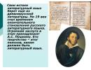
1. The initial stage of the study of Africa (2nd millennium BC - up to the 6th century) The beginning of the study of Africa dates back to ancient times. The ancient Egyptians explored the northern part of the continent, moving along the coast from the mouth of the Nile to the Gulf of Sidra, penetrating the Arabian, Libyan and Nubian deserts. Around 6th century. BC e. The Phoenicians made long sea voyages around Africa. In the 6th century. BC e. The Carthaginian Hanno the navigator undertook a voyage along the western coast of the continent. According to an inscription on a tablet he left in one of the temples of Carthage, he reached the interior of the Gulf of Guinea, where Europeans entered almost two thousand years later. During the period of Roman rule and later, fishing boats reached the Canary Islands, Roman travelers penetrated deep into the Libyan desert (L. C. Balbus, S. Flaccus). In 525, the Byzantine merchant, navigator and geographer Cosmas Indicoplov ascended the Nile River, crossed the Red Sea and traveled around the coast of East Africa. He left a 12-volume work, which served as the only source of information for its time about the Nile River and adjacent territories.

Slide 13
After the conquest of North Africa (7th century), the Arabs crossed the Libyan Desert and the Sahara Desert many times and began to study the Senegal and Niger rivers and Lake Chad. In one of the earliest geographical reports of Ibn Khordadbeh in the 9th century. contains information about Egypt and trade routes to this country. At the beginning of the 12th century. Idrisi showed North Africa on a world map, which was much more accurate than the maps then existing in Europe. Ibn Battuta in 1325-49, leaving Tangier, crossed northern and eastern Africa and visited Egypt. Later (1352-53) he crossed the Western Sahara, visited the city of Timbuktu on the Niger River and then returned back through the Central Sahara. The essay he left behind contains valuable information about the nature of the countries he visited and the customs of the peoples inhabiting them. The second stage of African exploration - Arab campaigns (7-14 centuries)

Slide 14
Ships of Vasco da Gama The third stage of the exploration of Africa - travels of the 15th - 17th centuries. Vasco da Gama - Portuguese traveler

15 slide
In 1498, the Portuguese explorer Vasco da Gama, completing the discovery of the sea route to India, circled South Africa, walked along the eastern coast of the mainland, crossed the Indian Ocean for the first time among Europeans and reached the coast of India.

16 slide
DAVID LEVINGSTON (1813-1873) Europeans began to explore the interior of Africa only at the end of the 19th century, when the rapidly developing countries of Europe needed land where they could extract cheap industrial raw materials and profitably sell finished goods. In the mid-19th century, the English explorer David Levingston made several trips inland. He crossed South Africa from west to east, explored the Zambezi River, and discovered a large beautiful waterfall on it, which he named in honor of Queen Victoria of England. He gave a description of the upper reaches of the Congo River, Lake Nyasa. The fourth stage is modern

Slide 17

18 slide
Exploration of Africa by Russian travelers and scientists Russian researchers made a great contribution to the study of the nature and life of the peoples of Africa. They set themselves the goal of exploring distant, unexplored countries and making the collected scientific materials the property of all humanity.
Geographical location and history of African exploration Grade 7 Geography teacher MOBU Secondary School No. 7 MO Korenovsky district of the Krasnodar Territory st. Dyadkovskoy Sinchenko Olga Vasilievna Purpose of the lesson: to study the geographical location of the continent of Africa and the history of its research PLANNED RESULTS To know: - a plan for characterizing the geographical location of the continent; - features of the geographical location of Africa; - names of outstanding foreign and Russian scientists and researchers of Africa, the results of their work. PLANNED RESULTS Be able to: - determine the geographical position of Africa, the coordinates of the extreme points, the length of the continent in degrees and kilometers; - name and show on the map objects of the African coastline. The most - the most on the continent of Africa
- Africa is the second largest by area (29.2 million km2) continent after Eurasia.
- The hottest continent on Earth (the highest t = +580 C in the city of Tripoli)
- Here is the largest desert in the world - the Sahara.
- Africa has the largest area of savannas (40% of the territory).
- Africa is home to the largest land animals - elephants, hippos, and rhinoceroses.
- The East African Rifts are the longest tectonic fault system on Earth.
- The highest point of the mainland is Mount Kilimanjaro (5895 km).
- The lowest point of the mainland is Lake Assal (-156 m).
- The longest river in the world is the Nile (6671 km).
- In Africa live the tallest people on Earth - the Nilotes and the shortest - the pygmies.
- Complete task 1(a) on p. in your workbook (Barinova I.I., Suslov V.G. Geography. Grade 7. Workbook. - M.: Exam, 2010) on the contour map. 28.
- In which climate zone does most of the continent lie?
- Red is the equator, blue is the prime meridian, green is the Northern and Southern Tropics. Write the names of the following geographical features:
- oceans: Atlantic, Indian;
- seas: Mediterranean, Red;
- gulfs: Guinea, Aden;
- straits: Gibraltar, Bab el-Mandeb, Mozambique;
- channel: Suez;
- island: Madagascar;
- peninsula: Somalia.
- Southernmost point of continent Africa: 1) Almadi metro station 2) Igolny metro station 3) Ras Hafun metro station 4) Good Hope metro station
- Zambezi River exploration and discovery Victoria Falls belongs to: 1) N.I. Vavilov 2) D. Livingston 3) E.P. Kovalevsky 4) V.V. Juncker
- Which researcher, while studying northeastern Africa, collected more 6,000 specimens of cultivated plants? 1) Vasco da Gama 2) E.P. Kovalevsky 3) A.V. Eliseev 4) N.I. Vavilov
- Study § 16
- Complete task No. 3 in writing, p. 76
- Learn the plan for describing the mainland's GP, p. 344
- Learn the nomenclature learned in class


 Back forward
Attention! Slide previews are for informational purposes only and may not represent all the features of the presentation. If you are interested in this work, please download the full version.
GOALS: create conditions for students to become familiar with the peculiarities of the geographical location of the continent, the extreme points, and the outline of the coastline. To acquaint students with the history of the discovery and exploration of Africa, with the most significant expeditions, with Russian and foreign travelers.
EDUCATIONAL TASKS: formation of skills to work in a team, assess the level of one’s knowledge, develop memory, and the ability to systematize learned material.
EQUIPMENT: “Physical map of the world”, “Physical map of Africa”, ICT, atlases, contour maps, workbook by I.I. Barinova, V.G. Suslov - Geography. Continents and oceans.
During the classes
I. Introduction
1. Class organization
II. Learning new material.
Geographical position.
a) the position of the continent relative to the equator, prime meridian, tropics;
b) the position of the continent in relation to the oceans and other continents;
Size of territory.
a) the extreme points of the continent (their latitude and longitude);
b) the extent of the continent from north to south and from west to east in degrees and in kilometers;
4. Outline of the coastline.
a) degree of ruggedness;
b) bays, straits, islands, peninsulas;
5. History of continental exploration. Working with the textbook.
III. Consolidation.
IV. Homework: No. 24. Workbook p. 28, pr.r. No. 8 (task 2).
Abstract
I. We are beginning to study the nature of the continents of the globe.
II. Lesson topic: “Geographical location and history of exploration of the African continent”
(slide number 1).
We face three tasks:
- Get acquainted with the geographical location of the mainland.
- Get acquainted with the size of the territory and the outline of the coastline.
- Name the names of the continent's researchers and the results of their work (slide No. 2).
A plan that describes the geographical location of any continent: (slide No. 3)
a) Position in relation to the equator, the prime meridian, and the tropics.
b) Position to the oceans and other continents.
Questions:
- Determine how the continent is located in relation to the equator? To the prime meridian? To the tropics?
- How is the continent located in relation to the Atlantic Ocean? To the Indian Ocean? To the Mediterranean Sea? To the Red Sea?
- How is the continent located in relation to other continents?
The continent of Africa is the closest to Eurasia. These two continents are connected by the Isthmus of Suez, through which the Suez Canal was dug in the 19th century. For what?
Conclusion: The geographical location of the continent of Africa is convenient, because... The continent has access to two oceans and the largest continent, Eurasia, is located nearby.
Go to the map and describe the geographical location of the continent.
Having considered the geographical location, let's move on to the borders (slide No. 4).
Open outline maps and atlas (physical map of Africa).
Since this is a continent, that means all borders are sea. In the north, the border runs along the Strait of Gibraltar, the Mediterranean Sea, and the Suez Canal. In the west along the Atlantic Ocean, in the east along the Indian Ocean. In the northwest, the border runs along the Red Sea.
Label the oceans and seas on the outline map.
To draw a conclusion about the size of the continent’s territory, let’s name the extreme points and determine the length of the continent from north to south and from west to east
(slide number 5).
- Name the northernmost point of the continent and its coordinates (Cape Ben Sekka - 37 o N 9 o E)
- Name the southernmost point of the continent and its coordinates (Cape Agulhas - 34 o S 19 o E)
- Name the westernmost point of the continent and its coordinates (Cape Almadi - 14 o N 17 o W)
- Name the easternmost point of the continent and its coordinates (Cape Ras Hafun - 10 o N 51 o E)
- Label the extreme points on the contour map.
- Determining the extent of the continent from north to south and from west to east (slide number 6).
Option I:
Determine the length of the continent from north to south in degrees and in kilometers of 20 o e.d. Northern point – 32 o north latitude South point – 34 o S 32 o +34 o =66 o
At 1 o The meridian is approximately 111 km. 111 km x 66 = 7326 km.
The length of the continent from north to south along 20 o E. – 7326 km.
Option II:
Determine the length of the continent from west to east in degrees and in kilometers at 20 o N latitude. Western point – 17 o W Eastern point – 38 o east. 38 o +17 o =55 o
At 1 o parallel 20 o N. –104.6 km 104.6 km x 55 =5753 km
The length of the continent from west to east along 20 o N latitude. - 5753 km.
The area of the continent is 30.3 million sq. km.
Conclusion: In terms of area, the continent of Africa is second only to the continent of Eurasia. The large area results in a variety of nature.
Having considered the geographical location, borders, and size of the territory, let’s move on to the outlines of the coastline.
How indented is the coastline of continent Africa? (slide No. 7)
The coastline is slightly indented.
We have already signed the seas off the coast of Africa (Mediterranean, Red).
- Name the straits (Mozambique, Gibraltar).
- Name the gulfs (Guinea, Aden).
- Sign on the outline map (slide No. 8).
- Name the largest peninsula (Somalia). Label on the outline map.
- Name the islands off the coast of the mainland (Madagascar, Canary Islands).
- Sign on the outline map (slide No. 9).
- Label the currents on the contour map - Benguela, Somali, Guinea
(slide number 10).
Conclusion: The coastline of the mainland is slightly indented. The ruggedness of the coastline affects the nature of the continent.
Let's get acquainted with the history of exploration of the mainland. Open your notebook and draw a table.
Option 1: You can give students an advanced task - to make small presentations themselves about travelers and explorers of Africa.
Option 2: using the textbook, paragraph 24, fill out the table (slide number 11).
| Traveler name | date | Opening |
The beginning of the study of Africa dates back to ancient times. The ancient Egyptians explored the northern part of the continent, moving along the coast from the mouth of the Nile to the Gulf of Sidra, penetrating the Arabian, Libyan and Nubian deserts. Around the 6th century. BC e. The Phoenicians made long sea voyages around Africa. During the period of Roman rule and later, fishing boats reached the Canary Islands, Roman travelers penetrated deep into the Libyan Desert (slide number 12). After the conquest of North Africa (VII century), the Arabs crossed the Libyan Desert and the Sahara Desert many times, and began to study the Senegal and Niger rivers , Lake Chad.
In 1417-1422, the Chinese naval commander ZhengHe, in one of his many campaigns, passed the Red Sea, rounded the Somali peninsula and, moving along the eastern coast, reached the island of Zanzibar (slide No. 12).
In the XV-XVI centuries. the study of Africa was associated with the Portuguese search for a sea route to India. B. Dias in 1445-1446 circumnavigated the westernmost point of Africa, which he called Cape Verde. B 1488 B . Dias discovered the extreme southern point of Africa, calling it the Cape of Storms (later renamed the Cape of Good Hope) (slide number 13); in 1500, not far from this cape, during a storm, B. Dias died (slide number 14).
Based on the reports of B. Dias, the route to India was developed by the Portuguese navigator Vasco da Gama (slide number 15). In 1497-1498, heading to India from Lisbon, he rounded the Cape of Good Hope and walked along the east coast to 3°S. (city of Malindi) (slide number 16). By the end of the 16th century. the contours of the continent were established (slides No. 17,18).
From the end of the 18th century. the desire to master new rich sources of natural resources stimulated the study of Africa by English, French and German travelers. Expeditions are concentrated in the interior regions of the continent. The British create a special “Association for Promoting the Discovery of the Interior of Africa,” which organized a number of important expeditions.
A great contribution to the study of Africa was made by the Scottish traveler D. Livingston, who was the first European to cross South Africa from west to east (1853-1856), simultaneously exploring a significant part of the Zambezi River basin and discovering Victoria Falls (1855). In 1867-1871 he explored the southern and western shores of Lake Tanganyika. In Europe, Livingston's expedition was considered lost and the journalist G. M. Stanley, who met Livingston in 1871 on Lake Tanganyika, went in search of him. Then they together examined the northern part of this lake and found out that it was not connected with the Nile (slides No. 19,20).
The Russian traveler V.V. Junker in 1876-1878 made a long journey through Central Africa, during which he made geographical and ethnographic observations and clarified the hydrography of the sources of the White Nile River. On the next expedition in 1879-1886, he explored the watershed of the Nile and Congo rivers; he summarized the results of his observations in the book “Travels in Africa” (slide No. 21).
In 1896-1900, the Russian traveler A.K. Bulatovich visited Ethiopia three times, surveyed the poorly studied southwestern and western regions of the country, and was the first European to cross the Kaffa mountain region. As a result of geographical research, by the end of the 19th century. Four great African rivers were studied: the Nile, Niger, Congo and Zambezi. Based on the collected geographical, historical and ethnographic information, Bulatovich wrote the books “From Entoto to the Baro River” (1897) and “With the troops of Menelik II. Diary of a hike from Ethiopia to Lake Rudolf” (St. Petersburg, 1900). For the latter, he was awarded a silver medal from the Russian Geographical Society (slide number 22).
Vavilov Nikolai Ivanovich (1887-1943), plant breeder, geneticist, geographer. Born in Moscow on November 13, 1887 (slide number 23). Nikolai Vavilov organized botanical and agronomic expeditions to the countries of the Mediterranean, North Africa, North and South America, and established on their territory ancient centers of origin and diversity of cultivated plants (slide No. 24). During the period 1926-1927, he collected 6,000 samples of cultivated plants and proved that Ethiopia is the birthplace of wheat.
At the beginning of the 20th century. The enormous natural resources of the African continent have been identified.
III. Consolidation
Blitz survey on the topic of the lesson (answers fit into the card prepared by the teacher)
(slide number 25).
1 option
1. Africa is ...... the largest continent in terms of territory.
2. Southernmost point of Africa:
1. Ben Sekka metro station
2. m. Ras Hafun
3. metro station Igolny
4. m. Almadi
3. Which ocean is Africa washed from the east?
1. Atlantic Ocean
2. Arctic Ocean
3. Indian Ocean
4. Pacific Ocean.
4. In which hemispheres is Africa located in relation to the equator?
1.in the Northern Hemisphere
2. both in Northern and
3. in the Southern Hemisphere
4. in the Southern Hemisphere.
5. A famous traveler who crossed South Africa from west to east, explored the Zambezi River, and discovered Victoria Falls.
1. Vavilov N.I.
2. D. Livingston
3. Vasco da Gama
4. Junker V.V.
Option 2
1. Area of Africa:
2. Northernmost point of Africa:
1. Ben Sekka metro station
5. Ras Hafun metro station
3. metro station Igolny
4. m. Almadi
3. In which hemispheres is Africa located relative to the prime meridian?
1. in the Western Hemisphere
2. both in Western and
4. in the Eastern Hemisphere
3. in the Eastern Hemisphere.
4. The seas belonging to which ocean wash Africa in the north?
1. Atlantic Ocean
2. Arctic Ocean
3. Indian Ocean;
4. Pacific Ocean.
5. The scientist who collected 6,000 samples of cultivated plants proved that Ethiopia is the birthplace of wheat.
1. Vavilov N.I.
2. D. Livingston
3. Vasco da Gama
4. Junker V.V.
IV. Homework: No. 24. Workbook p. 28, pr.r. No. 8 (task 2).

- What is the continent called?
- What continents do you know? Show them on the map.
- Which continents belong to the southern continents?
- Are all southern continents located entirely in the southern hemisphere?
- Problem task: P Why do we classify Africa, Australia, South America, and Antarctica as the southern continents?


- Physico-geographical position of the continent.
- Relief, tectonic structure, minerals.
- Climate.
- Inland waters.
- Soils.
- Natural areas. Flora and fauna.
- Population. Economic activity.
- States and capitals

- 1. Find out the features of the geographical location of Africa.
- 2. Learn to characterize the mainland’s GP.
- 3. Study the history of the discovery and exploration of the mainland.

"Introduction"
What did the poet want to tell us in these
a) “deafened by the roar and
stomping"
b) “clothed in flames and smoke”?
Was anything said about
“kinship” of Eurasia with Africa?
Deafened by the roar and stomp,
Cloaked in flames and smoke,
About you, my Africa, in a whisper
The seraphim speak in the skies.
About your deeds and fantasies,
Listen to the animal soul,
You are on an ancient tree of Eurasia
A gigantic hanging pear.

1. Africa is almost in the middle
intersected by the equator
2. Most of it lies between the tropics, so Africa is the hottest continent.
3. Africa is the second largest continent, after Eurasia.
4. About ½ of Africa's territory is occupied by deserts and semi-deserts.

- The position of the continent in relation to the equator.
- The position of the continent in relation to the prime meridian.
- Extreme points, their coordinates.
- The length of the continent from North to South and from West to East in degrees and kilometers.
- Area of the continent.
- The position of the continent in relation to the seas and oceans.
- The position of the continent in relation to other continents.
- Conclusion: about the peculiarities of the physical and geographical position of the continent


END POINTS
1 . North – Cape Ras Angela
Geographical coordinates
37gr. north latitude and 10 gr. e.d.
2. South - Cape Agulhas
Geographical coordinates
36 gr. S and 20 gr. e.d.
3. Western - Cape Almadi
Geographical coordinates
15 gr. n.sh and 16 gr. w.d.
4. Eastern – Cape Ras Hafun
Geographical coordinates
12 gr. n.sh and 52 gr. e.d.

Determine the size of the continent
1. Distance from north to south
along the 20th meridian in degrees and km
32 + 37 = 69 (degrees)
69 x 111 = 7659 (km)
2. Distance from west to east along the 10th parallel in degrees and km
15 + 52 = 67 (degrees)
67 x 109.6 = 7343.2 (km)
3. Compare distances,
draw conclusions

- Extreme northern point - Cape Ben Seka 37ºN. 9ºE
- Extreme southern point – Cape Agulhas 35 ºS. 20ºE
- Extreme western point – Cape Almadi 15ºN. 18ºW
- Extreme eastern point – Cape Ras Hafun 10ºN. 52ºE

Length of continent
N – S
37 º +35 º =72 º
111km * 72 º =7992 km
W – E
1) 52 º +18 º =69 º
2) 110 km * 70 º = 7700 km


Africa - continent , located south of Mediterranean And Red seas, east of Atlantic Ocean and west of Indian Ocean . It is the second largest continent after Eurasia . Also called Africa part of the world , consisting of mainland Africa and adjacent islands. Africa's area is 30,065,000 km², or 20.3% of the land area, and with the islands - about 30.2 million km², thus covering 6% of the total surface area of the Earth and 20.4% of the land surface. Located in Africa 53 states, 4 unrecognized states and 5 dependent territories (island).

Fizminutka
A giraffe has spots everywhere:
On the forehead, ears, neck, elbows,
There are on noses, on bellies,
Knees and toes.


History of African exploration
The initial stage of African exploration
Africa has long attracted the attention of the peoples of Southern Europe and South-West Asia. These peoples knew the northern and eastern African coasts well. The Portuguese search for a sea route to India expanded European acquaintance with the African coast.

The second stage of African exploration - travel in the 15th - 17th centuries.
Ships Vasco da Gama
Vasco da Gama -
Portuguese traveler

Vasco da Gama route
In 1498, the Portuguese explorer Vasco da Gama, completing the discovery of the sea route to India, circled South Africa, walked along the eastern coast of the mainland, crossed the Indian Ocean for the first time among Europeans and reached the coast of India.

The third stage is modern
DAVID LEVINGSTON (1813-1873)
Europeans began exploring the interior of Africa only in the 19th century, when the rapidly developing countries of Europe needed land where they could extract cheap industrial raw materials and profitably sell finished goods.
In the mid-19th century, the English explorer David Levingston made several trips inland. He crossed South Africa from west to east, explored the Zambezi River, and discovered a large beautiful waterfall on it, which he named in honor of Queen Victoria of England.
He gave a description of the upper reaches of the Congo River, Lake Nyasa.

Russian exploration of Africa
travelers and scientists
Russian researchers made a great contribution to the study of the nature and life of the peoples of Africa. They set themselves the goal of exploring distant, unexplored countries and making the collected scientific materials the property of all humanity.

VASILY VASILIEVICH YUNKER
Traveled through Central and East Africa at the end of the 19th century. He collected interesting information about the nature and life of the population of these areas of the mainland.
Conducted topographical work, conducted hydrological and meteorological observations. Wrote a book, Travels in Africa.

A significant contribution to the study of the northeastern part of the continent at the end of the 19th century was made by Yegor Petrovich Kovalevsky, Alexander Vasilyevich Eliseev and other Russian researchers.
Eliseev A.V.
Kovalevsky E.P.

In 1926-1927 An expedition was organized to the northeastern part of the continent to study the cultivated plants of Africa. It was headed by the greatest scientist Nikolai Ivanovich Vavilov.
More than 6,000 samples of cultivated plants were collected. Vavilov established that Ethiopia is the birthplace of valuable (durum) varieties of wheat.

Expedition time
Researchers
Vasco da Gama
Ser 19th century
results
David Livingston
Late 19th century
The outlines of the continent in the south have been determined
V.V. Junker
Late 19th century
Explored South Africa, the Zambezi and Congo rivers, discovered Victoria Falls
Explored Central and East Africa, collected information about the nature and population of these areas
E.P. Kovalevsky and A.V. Eliseev
N.I.Vavilov
Exploring the northeastern part of the mainland
Study of cultivated plants of the northeastern part of the mainland

FIXING
1. What are the features of the continent’s geographical location?
2. What is the size of the continent?
3. How rugged is the coastline?
4. What geographical features separate Africa from Europe?
and Asia?
5. Name the extreme points of Africa
6. Which Russian researchers studied the mainland?
7. What contributions did David Levingston make to African exploration?

- Complete task 1, 3 in the contour map on page 4.
- Table

Presentation completed
Geography teacher at gymnasium No. 18
Magnitogorsk 2011
Initially, the inhabitants of ancient Carthage used the word “Afri” to refer to people who lived near the city. This name is usually attributed to the Phoenician afar, meaning "dust". After the conquest of Carthage, the Romans called the province Africa (lat. Africa). Later, all known regions of this continent, and then the continent itself, began to be called Africa.
Download:
Preview:
To use presentation previews, create a Google account and log in to it: https://accounts.google.com
Slide captions:
The history of the discovery and exploration of the continent of Africa.
Africa is the second largest continent after Eurasia. Africa is also the name given to the part of the world consisting of the continent of Africa and adjacent islands. Africa has an area of 30,065,000 km², or 20.3% of the land area, and with islands about 30.2 million km², thus covering 6% of the Earth's total surface area and 20.4% of the land surface.
History of the name of the continent Africa. Initially, the inhabitants of ancient Carthage used the word “Afri” to refer to people who lived near the city. This name is usually attributed to the Phoenician afar, meaning "dust". After the conquest of Carthage, the Romans called the province Africa (lat. Africa). Later, all known regions of this continent, and then the continent itself, began to be called Africa. Another theory is that the name "Afri" comes from the Berber ifri, "cave", referring to cave dwellers. The Muslim province of Ifriqiya, which later arose in this place, also retained this root in its name.
Discovery and exploration of the continent. E.
Explorers, travelers Country Period of research Contribution to research Ancient Greeks Populated and explored the northern part of Africa Egyptians Populated and explored the northeastern part of Africa Bartolomeu Dias 1450 - 1500. Portugal XV-XVI centuries. Discovered the Cape of Good Hope and circled the southern tip of the continent. Discovered the southwestern coast of Africa south of the mouth of the Congo River. Vasco da Gama 1469 – 1524 Portugal XV-XVI centuries. He circumnavigated South Africa, walked along the eastern coast of the continent, crossed the Indian Ocean for the first time among Europeans and reached the coast of India. Completion of the discovery of the shores of the mainland Mungo Park 1771-1806. England Late 18th century The flow of the Niger River was traced in detail by Heinrich Barth 1821-1865. Prussia Mid-19th century Explored Lake Chad and the Sahara Desert by David Livingston 1813 - 1873. England 19th century Exploration of the Zambezi River, discovered Victoria Falls, studied the upper reaches of the Congo River, Lake Nyasa Henry Stanley Morton 1841 - 1904. USA 19th century Sailing around Lake Tanganyika and Victoria and from the source to the mouth of the Congo River. Discovery of the Kagera River and the Rwenzori Massif. Egor Petrovich Kovalevsky 1811-1868 Russia Late 19th century Exploring Northeast Africa. Determination of the sources of the White Nile, and description of Abessinia (currently the state of Ethiopia). Vasily Vasilyevich Juncker 1840 – 1892 Russia Late 19th century Study of Central and Eastern Africa, carried out topographic work, meteorological and hydrological observations History of the study.
1450 – 1500 Portuguese navigator. In 1488, in search of a sea route to India, he was the first European to circumnavigate Africa from the southwest, discover the Cape of Good Hope and reach the Indian Ocean. Discovered the southwestern coast of Africa south of the mouth of the Congo River. Bartolomeu Dias
1469 – 1524 The Portuguese navigator was the first European to cross the Indian Ocean and reach the coast of India. During his journey, he circled South Africa and walked along the eastern coast of the continent. Vasco da Gama.
1771-1806 Scottish explorer of Central Africa. Made two trips to West Africa. Explored a long stretch of the Gambia and Niger rivers Mungo Park
1813 – 1873 English traveler to Africa. Livingston lived in Africa for twenty-eight years as a missionary and explorer. During his travels, Livingston determined the position of more than 1000 points; He was the first to point out the main features of the relief of Southern and Central Africa, studied the system of the Zambezi River and the upper reaches of the Congo River, and compiled a modern map of the “Black Continent.” Victoria Falls was discovered. He laid the foundation for the scientific study of the large lakes Nyasa and Tanganyika. A city in Zambia, mountains in East Africa, and waterfalls on the Congo River (Zaire) are named after Livingstone. David Livingston
The city of Kuruman, where David Livingston lived for eight years.
The steamboat on which David Livingstone sailed along the Zambezi.
Victoria Falls - the discovery of David Livingstone. Opening date: 1855. The height of the waterfall is 119 m.
1841 – 1904 Journalist, researcher of Africa. Went to Africa in search of the missing D. Livingston. I met him near Lake Tanganyika and explored this lake with him. In 1874-77 he crossed Africa from East to West at the head of the Anglo-American expedition. From Zanzibar I reached Lake Victoria and established its outline. Discovered the Rwenzori mountain range and lakes Edward (Idi-Amin-Dada) and George; explored the flow of the river. Kagera, traveled around Lake Tanganyika, then reached the Lualaba River and found out that it was the headwaters of the river. Congo (Zaire); he went down this river to the mouth, putting on the map the middle part of its course, unknown to Europeans. In 1879-84 he discovered lakes Leopold II (Mai-Ndombe) and Tumba. In 1887-89, at the head of an English expedition, he again crossed Africa (from West to East); explored the Aruvimi River and established that Lake Edward belongs to the Nile system. Waterfalls in the upper Congo are named after him. Stanley Henry Morton
David Livingston and Henry Stanley Morton on Lake Tanganyika.
1821 – 1865 Heinrich Barth German historian, philologist, geographer and traveler. In 1850-1855 he was a member of J. Richardson's expedition to Africa; crossed the Sahara twice. Over the course of six years, he traveled more than 20 thousand kilometers across the Sahara and Sudan, collecting geographical, ethnographic and linguistic materials. He was the first European to collect oral traditions and discover Tariq es-Sudan, the most valuable chronicle of the 17th century, for European science, as well as many other manuscripts. The main work is “Travel and Discoveries in North and Central Africa” (in 5 volumes).
1811-1868 Egor Petrovich Kovalevsky Famous traveler and writer. In 1847, at the invitation of the Egyptian Viceroy Megmet Ali, he carried out geological surveys in northeast Africa. He was one of the first to correctly speak about the geographical location of the sources of the White Nile, which were precisely determined much later. In addition, he wrote a book: “Journey to Inner Africa,” which included a detailed description of Abessinia.
1840 – 1892 Russian geographer and traveler, one of the first explorers of Africa, participant in ethnographic expeditions of the Russian Geographical Society. Honorary member of the Imperial Russian Geographical Society. Awarded the gold medal of the Royal Geographical Society (Great Britain) for his contribution to the study of the African continent. Studied Central and East Africa. Explored the watershed of the Congo and Nile rivers. Conducted topographic work, meteorological and hydrological observations. Junker compiled dictionaries of ten black tribes, collected a large ethnographic collection, the most valuable collections of plants and animals of Africa, and discovered an animal then unknown to science - the woolly wing. Vasily Vasilievich Junker